Canadian Hydrographic Service (CHS)
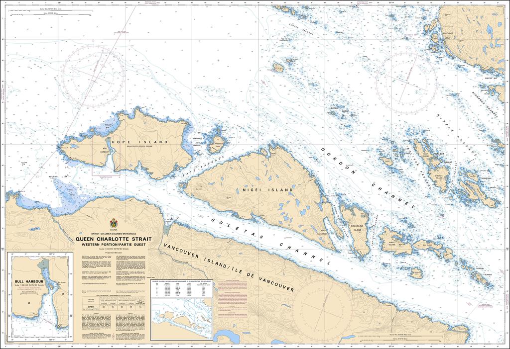
Canadian Nautical Chart #3549 - Queen Charlotte Strait (Western)
Canadian Nautical Chart #3549 - Queen Charlotte Strait (Western)
Couldn't load pickup availability
Share
Set your course for adventure with Canadian Nautical Chart #3549 – Queen Charlotte Strait (Western Portion), a stunning chart that belongs aboard every boater's wall and every navigator's collection! Whether you're planning your next coastal voyage or adding maritime character to your home, this chart delivers timeless West Coast appeal.
Covering the western reaches of Queen Charlotte Strait, this detailed Canadian Hydrographic chart features Hope Island, Nigei Island, Balaklava Island, and the picturesque Walker Group Islands, an area celebrated for rugged shorelines, rich marine life, and exceptional cruising waters. The surrounding passages have guided Indigenous mariners for thousands of years, while later becoming an important route for explorers, traders, and coastal shipping along British Columbia's spectacular coastline.
Measuring an impressive 48" x 36" at a detailed 1:40,000 scale, this nautical chart is equally suited for voyage planning, geographic reference, or eye-catching nautical décor. Whether you're a seasoned captain, kayaker, angler, or maritime history enthusiast, Canadian Nautical Chart #3549 brings the beauty, history, and spirit of Queen Charlotte Strait to every adventure—on the water or displayed with pride at home.
SKU: SKU:CHY3549
View full details