Canadian Hydrographic Service (CHS)
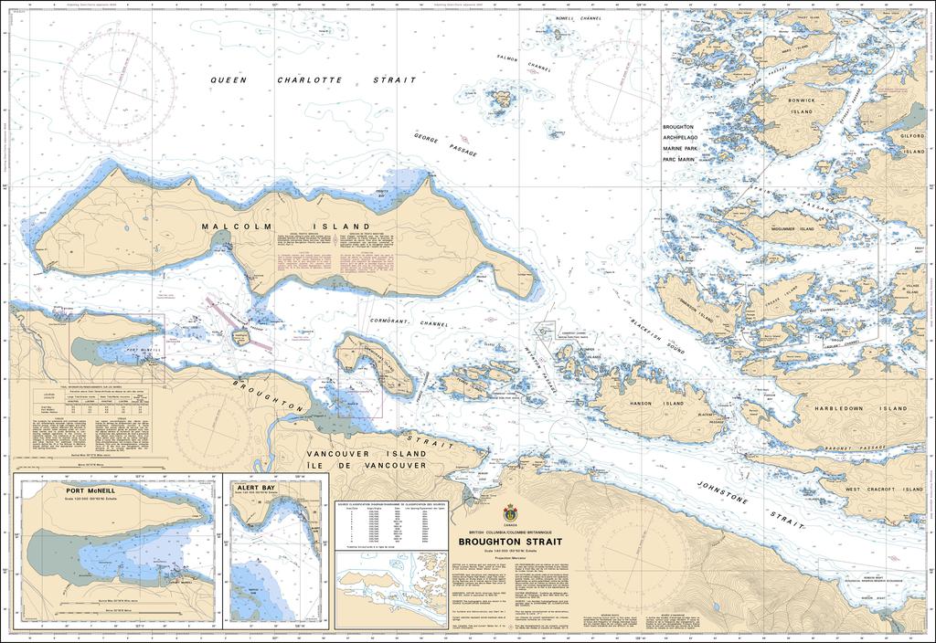
Canadian Nautical Chart #3546 - Broughton Strait
Canadian Nautical Chart #3546 - Broughton Strait
Couldn't load pickup availability
Share
Chart a course for adventure with Canadian Nautical Chart #3546 – Broughton Strait, a stunning blend of maritime history, coastal exploration, and nautical décor. Whether you're a boater, chart collector, or Pacific Northwest enthusiast, this impressive chart brings one of British Columbia’s most fascinating waterways right into view.
Printed at a generous 48" x 36" and featuring a detailed 1:40,000 scale, this nautical chart covers the scenic waters of Broughton Strait and surrounding passages along the rugged northeastern coast of Vancouver Island. Explore charted waters near Port McNeill, Malcolm Island, Cormorant Island, Alert Bay, and the maze-like channels that make this region a favorite among sailors, kayakers, anglers, and wildlife watchers.
The area is rich in maritime history and Indigenous heritage. Broughton Strait was named during Captain George Vancouver’s 1792 expedition, a voyage that helped map much of the Pacific Northwest coastline.
Perfect for both decoration and exploration, this Canadian nautical chart looks fantastic framed in a home, office, cabin, or yacht while also serving as a valuable reference for dreaming up future coastal adventures. It’s a timeless piece that celebrates the beauty and history of British Columbia’s legendary Inside Passage.
SKU: SKU:CHY3546
View full details