Canadian Hydrographic Service (CHS)
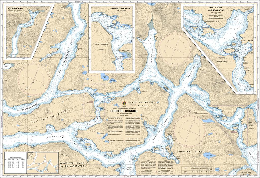
Canadian Nautical Chart #3543 - Cordero Channel
Canadian Nautical Chart #3543 - Cordero Channel
Couldn't load pickup availability
Share
Chart a course through one of British Columbia's most breathtaking coastal waterways! Canadian Nautical Chart #3543 - Cordero Channel is the perfect companion for adventurous boaters, coastal explorers, and anyone who loves the rugged beauty of the Pacific Northwest.
Covering Cordero Channel and the surrounding network of waterways at a detailed 1:80,000 scale, this official Canadian nautical chart features key navigation information for spectacular destinations including Sonora Island, East Thurlow Island, West Thurlow Island, Stuart Island, Phillips Arm, Chancellor Channel, Greene Point Rapids, and the community of Rock Bay. Measuring an impressive 48" x 36", this large-format chart offers exceptional detail for trip planning, route reference, or eye-catching coastal décor.
These historic waterways played a vital role in the maritime fur trade and later became essential routes for logging vessels, fishing fleets, and coastal communities throughout British Columbia's development.
Whether displayed as striking nautical wall art or used to inspire your next voyage, Canadian Nautical Chart #3543 - Cordero Channel beautifully blends maritime history, coastal exploration, and timeless navigational craftsmanship into one remarkable chart.
This version is optimized for SEO, online shopping, and emphasizes both its practical navigation value and its appeal as decorative nautical wall art.
SKU: SKU:CHY3543
View full details