Canadian Hydrographic Service (CHS)
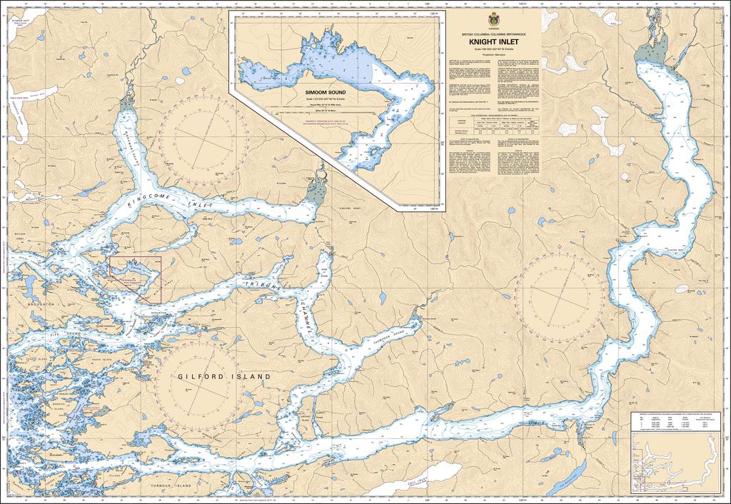
Canadian Nautical Chart #3515 - Knight Inlet
Canadian Nautical Chart #3515 - Knight Inlet
Couldn't load pickup availability
Share
Set your course for adventure with Canadian Nautical Chart #3515 – Knight Inlet, where breathtaking coastal wilderness meets dependable marine navigation! Whether you're planning your next voyage or decorating your home with authentic nautical style, this chart is a stunning choice.
Covering spectacular Knight Inlet on British Columbia's rugged central coast, this Canadian Nautical Chart details winding waterways, secluded coves, and the dramatic shoreline surrounding Gilford Island, Simoom Sound, Tribune Channel, Bond Sound, and the communities of Glendale Cove and Minstrel Island. At a detailed scale of 1:80,000 and an impressive 48" x 36" size, it's perfect for route planning, trip preparation, or displaying as captivating wall art.
Knight Inlet is famous as one of the longest fjords on the British Columbia coast and played an important role during the late 18th-century exploration of the Pacific Northwest, when European expeditions first charted these remarkable waters.
Ideal for boaters, kayakers, anglers, and coastal explorers, this chart is equally at home aboard your vessel or showcased as a striking reminder of unforgettable adventures along Canada's magnificent Pacific coastline.
SKU: SKU:CHY3515
View full details