Canadian Hydrographic Service (CHS)
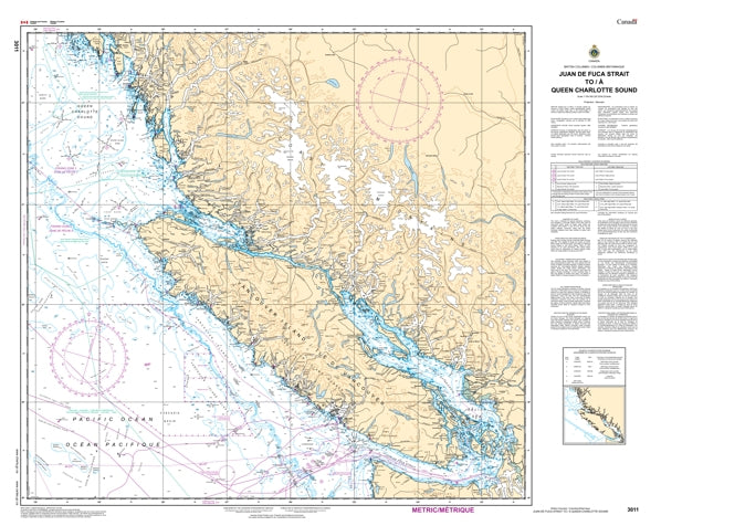
Canadian Nautical Chart #3011 Juan de Fuca Str to Queen Charlotte Snd
Canadian Nautical Chart #3011 Juan de Fuca Str to Queen Charlotte Snd
Couldn't load pickup availability
Share
Set your course for adventure with Canadian Nautical Chart #3011, covering one of the most spectacular stretches of the Pacific Northwest! Whether you're planning your next voyage or creating the perfect coastal display, this chart is ready to inspire every nautical enthusiast.
Canadian Nautical Chart #3011 spans from the rugged waters of Juan de Fuca Strait to the wild coastline of Queen Charlotte Sound at a scale of 1:700,000, offering exceptional coverage of Vancouver Island's west coast, Barkley Sound, Clayoquot Sound, Nootka Sound, Brooks Peninsula, and countless islands, inlets, and offshore waters. Measuring an impressive 47" x 36", this large-format chart is perfect for route planning, coastal reference, or eye-catching nautical décor.
These legendary waters played a major role during the late 1700s as British and Spanish explorers charted the Pacific Northwest, shaping the region's maritime history. Today, this classic Canadian nautical chart is equally at home guiding dreams of future adventures or decorating a home, office, cabin, or boat with authentic maritime style. It's the perfect blend of exploration, history, and coastal inspiration.SKU: SKU:CHY3011
View full details