Canadian Hydrographic Service (CHS)
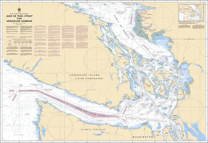
Canadian Chart 3601, Juan de Fuca Strait to Vancover Harbour
Canadian Chart 3601, Juan de Fuca Strait to Vancover Harbour
Couldn't load pickup availability
Share
The Canadian Hydrographic Service (CHS) is a cornerstone of maritime safety in Canada, providing essential nautical charts crucial for safe navigation.
CHS Chart 3601, spanning from the Strait of Juan de Fuca to Vancouver Harbour, is a prime example of their dedication.
This official Canadian chart meticulously details key features such as the San Juan Islands, Gulf Islands, Northern Olympic Peninsula, Port Townsend, and Southern Vancouver Island.
Known for its accuracy and reliability, CHS Canadian Nautical Chart 3601 Juan de Fuca Strait to Vancouver Harbour serves as an indispensable tool for navigators.
Whether for recreational boating or commercial shipping, this chart offers vital information to enhance situational awareness and mitigate navigational risks along this significant maritime route.
CHS's commitment to maritime safety is evident in the meticulous detail and usability of CHS Chart 3601, making it an essential companion for safe navigation in Canada's coastal waters.
Articles:
SKU: SKU:CHY3601
View full details