Canadian Hydrographic Service (CHS)
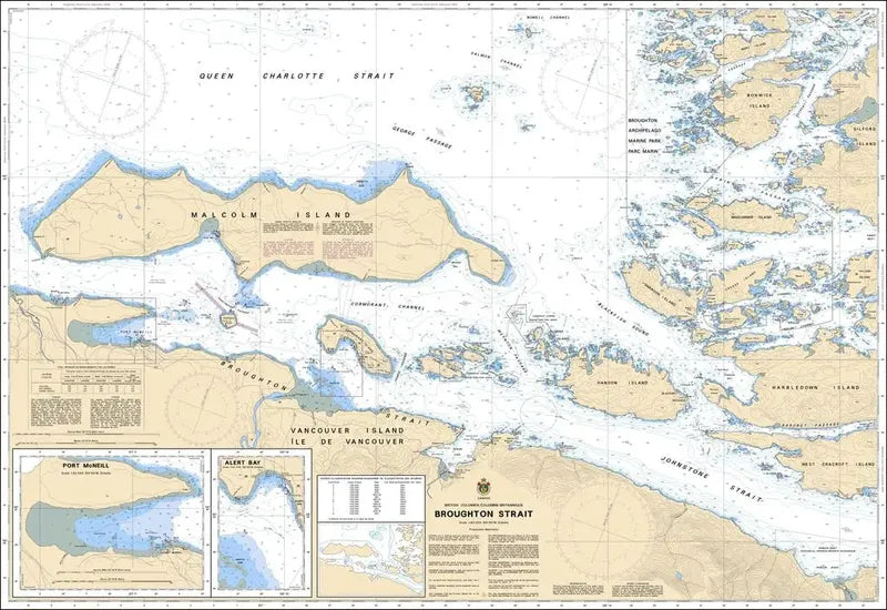
Canadian Chart 3546, Broughton Strait
Canadian Chart 3546, Broughton Strait
Couldn't load pickup availability
Share
Size/Scale: 44" x 31" / 1:40,000
The Canadian Hydrographic Service (CHS) is pivotal in ensuring the safety of navigation across Canada's waterways, providing indispensable nautical charts for mariners.
CHS Canadian Chart 3546 Broughton Strait stands out as a crucial resource, focusing on the intricate waterways of the Broughton Strait in British Columbia.
Renowned for its accuracy and reliability, CHS Canadian Chart 3546 Broughton Strait serves as an indispensable tool for navigators.
Whether for recreational boating or commercial shipping, this chart offers essential information to enhance situational awareness and mitigate navigational risks in the region.
Articles:
SKU: SKU:CHY3546
View full details