Canadian Hydrographic Service (CHS)
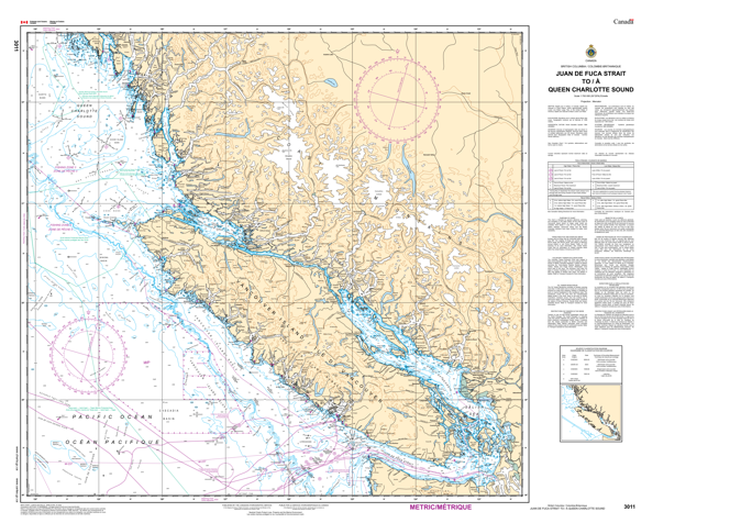
Canadian Chart 3011, Juan de Fuca to Queen Charlotte Island
Canadian Chart 3011, Juan de Fuca to Queen Charlotte Island
Couldn't load pickup availability
Share
The Canadian Hydrographic Service (CHS) is at the forefront of ensuring safe navigation along Canada's extensive waterways, with its nautical charts serving as indispensable tools for mariners.
As the official Canadian Hydrographic Service chart, CHS Chart 3011 is accurate and reliable, providing essential information to navigate the intricate water passages around Vancouver Island.
Whether for recreational boaters or commercial vessels, this chart is essential for enhancing situational awareness and mitigating navigational risks.
CHS's dedication to maritime safety shines through in the meticulous detail and usability of CHS Chart 3011, making it an indispensable asset for safe navigation in Canada's coastal waters.
Articles:
SKU: SKU:CHY3011
View full details