Canadian Hydrographic Service (CHS)
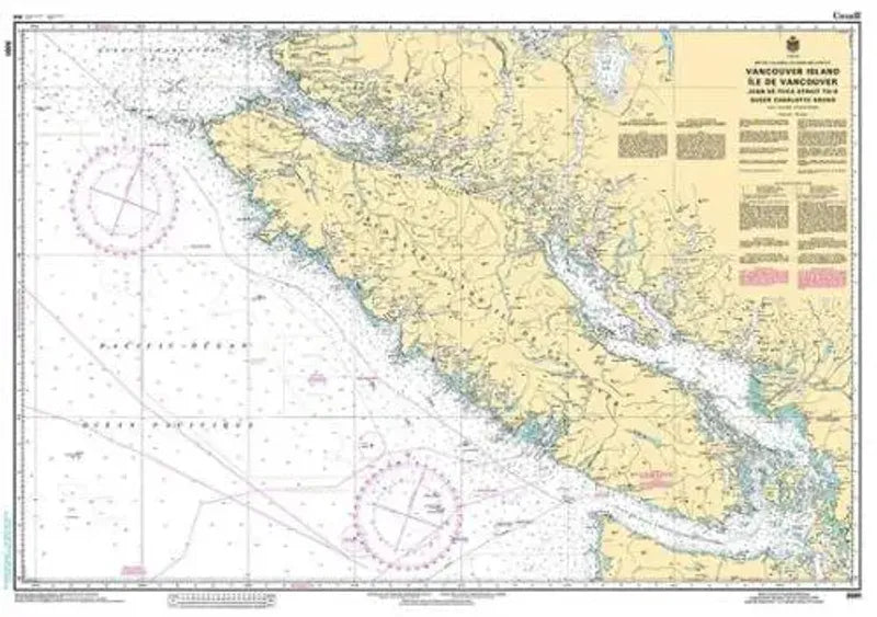
Canadian Chart 3001, Vancouver Island
Canadian Chart 3001, Vancouver Island
Couldn't load pickup availability
Share
Size/Scale: 1:525,000 | 47" x 33"
The Canadian Hydrographic Service (CHS) plays a pivotal role in ensuring the safety of navigation throughout Canada's vast waterways.
Among its indispensable resources is the CHS Chart 3001 of Vancouver Island, meticulously detailing the entirety of this iconic landmass.
This official Canadian chart offers comprehensive coverage of Vancouver Island, including intricate features such as inlets, sounds, and more, crucial for safe maritime passage.
Recognized for its accuracy and reliability, CHS Canadian Chart 3001 of Vancouver Island serves as an essential tool for sailors, mariners, and navigators, providing vital information to enhance situational awareness and mitigate navigational risks.
Whether for recreational boating, commercial shipping, or maritime operations, this chart remains a trusted companion, reflecting CHS's commitment to upholding the highest standards of maritime safety and facilitating smooth navigation along Canada's diverse coastal regions.
SKU: SKU:CHY3001
View full details