National Geographic
Camino de Santiago Great Treks Planning Map by Nat Geo #5601
Camino de Santiago Great Treks Planning Map by Nat Geo #5601
Couldn't load pickup availability
Share
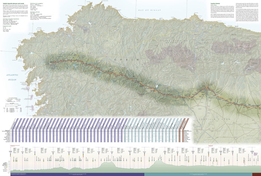
The journey of a lifetime starts with a single map! Whether you're dreaming about walking the legendary Camino or counting down the days until your adventure begins, the Camino de Santiago Great Treks Overview & Planning Map by National Geographic is your perfect travel companion.
Covering the world-famous Camino Francés, this beautifully designed planning map guides you along the full 780-kilometer (485-mile) pilgrimage from Saint-Jean-Pied-de-Port across the Pyrenees to the magnificent Cathedral of Santiago de Compostela. Follow the historic route through iconic destinations including Pamplona, Logroño, Burgos, and León while discovering charming villages, breathtaking landscapes, and centuries of history along the way.
Packed with practical planning tools, you'll find stage markers, cumulative distances, elevation profiles, slope information, lodging, restaurants, campsites, and nearby bus and rail stations, making every step easier to plan. Whether you're a first-time pilgrim or returning for another unforgettable trek, this map keeps your adventure organized from start to finish.
Printed on National Geographic's waterproof, tear-resistant synthetic paper, this rugged map is built to handle every mile of your Camino—rain, sunshine, and countless unforgettable memories included.
SKU: SKU:TRA5601
View full details