National Geographic
California State Wall Map by National Geographic
California State Wall Map by National Geographic
Couldn't load pickup availability
Share
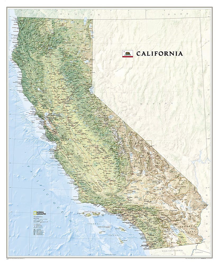
National Geographic’s California State Wall Map is a breathtaking showcase of the Golden State’s diverse landscapes and iconic landmarks. Measuring 34" x 41", this richly detailed map captures California’s natural beauty—from the sun-scorched Sonoran and Mojave deserts to the lush Redwood Empire, the fertile Central Valley, and the snowcapped Sierra Nevada Mountains. Stunning shaded relief brings mountains, valleys, and coastal depths to life, while vibrant colors highlight forests, deserts, and waterways.
Geographic details include prominent peaks, islands, rivers, lakes, reservoirs, and the locations of cities, towns, airports, and military bases. National and state parks are clearly marked, along with the famed Pacific Crest Trail, which stretches the state’s entire length from Mexico to Oregon. Perfect for classrooms, offices, or home décor, this map blends scientific precision with artistic beauty, making it both an educational tool and a visual centerpiece for anyone who loves California’s vast and varied geography.
ArticlesSKU: SKU:NGSCAP
View full details