The MapShop
California Raised Relief Map (Raven Colors)
California Raised Relief Map (Raven Colors)
Couldn't load pickup availability
Share
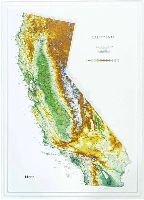
California Raised Relief Map: Bring the stunning topography of California to life with this carefully crafted Raised Relief Map, an essential piece for geography enthusiasts, educators, and adventurers alike. This three-dimensional map, made of durable molded plastic, offers a tactile experience that goes beyond the flat, traditional map, allowing you to explore the diverse landscapes of the Golden State in exquisite detail.
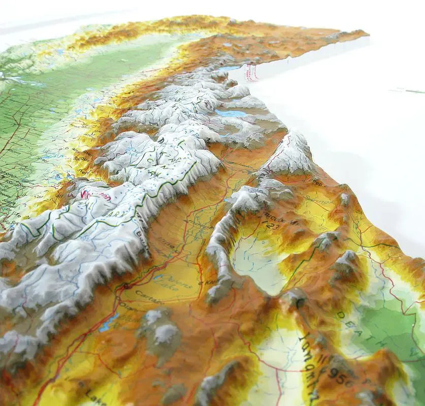
California Raised Relief Map Peaks and Ranges: Standing as the state’s crowning glory, Mount Whitney rises prominently on this map, offering a tangible representation of the highest peak in the contiguous United States at 14,505 feet. The Sierra Nevada mountain range, renowned for its rugged beauty and home to iconic landmarks like Lake Tahoe and Yosemite National Park, is intricately detailed, showcasing its undulating peaks and deep valleys. Travel down the map to trace the backbone of California’s coastal geography—the Coastal Ranges. From the rolling hills of the North Coast Ranges, including the dramatic elevation of Mount Shasta, to the scenic Santa Lucia Range that shelters the stunning Big Sur coastline, each peak and valley is captured in sharp relief.
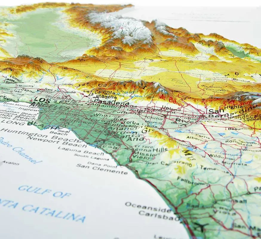
California Raised Relief Map Geographic Features: The California Raised Relief Map labels major rivers, lakes, towns, and highways, making it not just a visual marvel but a functional reference tool. The Sacramento and San Joaquin rivers wind through the Central Valley, which is etched in the center of the state, offering a glimpse into the state’s agricultural heartland. Coastal cities like San Francisco and Los Angeles are also marked, along with key inland towns, making it easy to navigate from one region to another.
Raised Relief Maps are printed on vinyl and are not intended to roll and/or fold. We ship them in a flat box and pack them with love (i.e. Plenty of bubble wrap!)
SKU: SKU:TMSSTCARAV
View full details