

Custom Correct
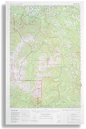
Buckhorn Wilderness Trail Map
Buckhorn Wilderness Trail Map
Couldn't load pickup availability
Share
The Buckhorn Wilderness Trail Map by Custom Correct is a great tool for exploring the rugged beauty of the Olympic Mountains' northeast corner. Covering the heart of the Buckhorn Wilderness in Olympic National Forest, this map details the extensive network of trails winding through deep river drainages, towering peaks, and remote alpine landscapes. It includes the Dungeness and Quilcene River basins, as well as iconic summits like Mount Constance, Mount Deception, and the Needles.
Designed for adventurers seeking both solitude and challenge, the map provides clear, accurate representation with a 1:62,500 scale and 50-foot contour intervals. Every trail within or leading into the Buckhorn Wilderness is marked, ensuring hikers and backpackers have the essential details they need. Whether you’re aiming for the breathtaking views from Mount Townsend or traversing the wild backcountry, this map is a reliable companion for your Olympic exploration.
SKU: SKU:LREBW
View full details