1
/
of
1
National Geographic
Britain & Ireland Wall Map by National Geographic
Britain & Ireland Wall Map by National Geographic
Regular price
$26.95 USD
Regular price
Sale price
$26.95 USD
Unit price
/
per
Couldn't load pickup availability
Share
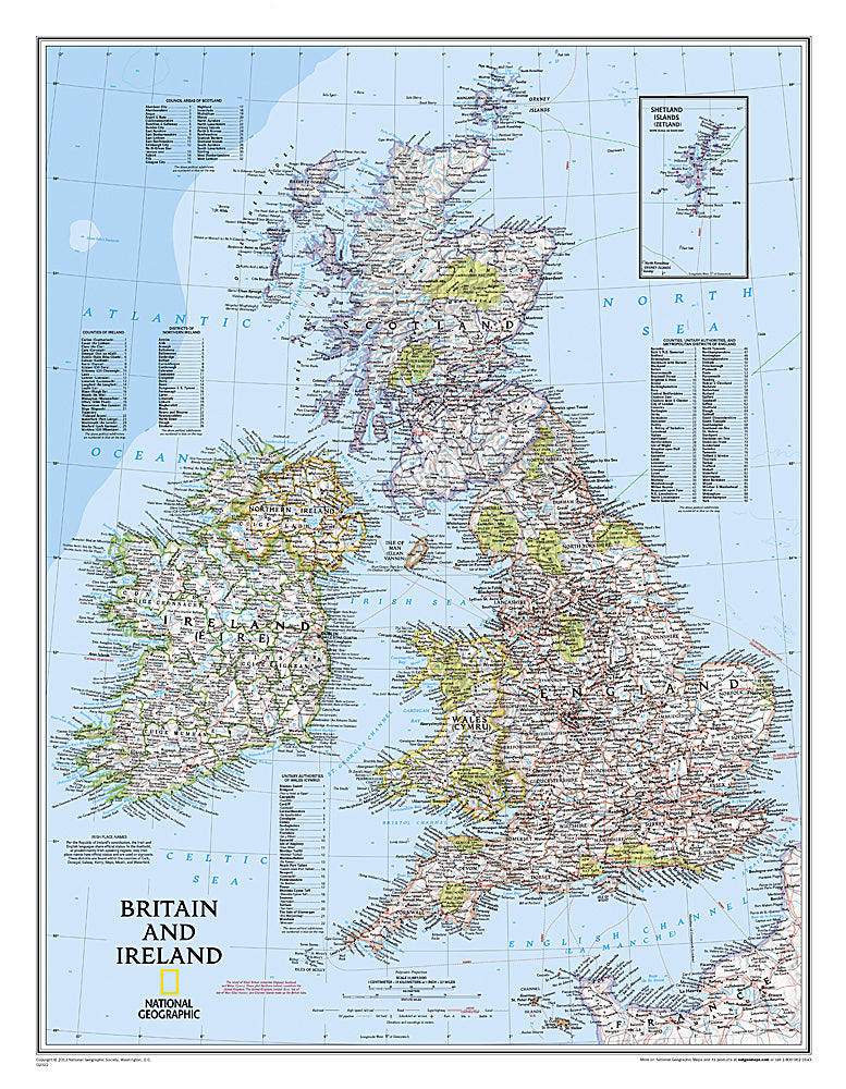
National Geographic’s Britain & Ireland Wall Map is a stunning blend of beauty and detail, perfect for classrooms, offices, or home décor. Measuring 23.25" x 29.75", this political map captures the rich geography and culture of England, Scotland, Wales, Northern Ireland, and the Republic of Ireland.
Thousands of place names, major roads, ferry routes, airports, and bodies of water are clearly labeled, while shaded relief reveals the varied landscapes—from the Scottish Highlands to the rolling hills of Wales. Green vignettes highlight national parks, and an inset provides detailed coverage of the Shetland Islands. Place names appear in both English and Irish Gaelic, with authentic Irish-only names shown in Gaeltacht regions such as Cork, Galway, and Donegal.
Whether you’re a traveler, student, or history enthusiast, this wall map offers both an educational resource and a visual celebration of Britain and Ireland’s natural beauty, historic regions, and vibrant cultural heritage.
SKU: SKU:NGSBI
View full details