National Geographic
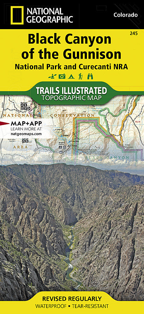
Black Canyon of the Gunnison NP Trails Illustrated Topo Map #245
Black Canyon of the Gunnison NP Trails Illustrated Topo Map #245
Couldn't load pickup availability
Share
Discover the stunning Black Canyon of the Gunnison National Park with National Geographic’s Trails Illustrated Topographic Map #245. This 48-mile deep, dramatic canyon carved by the Gunnison River boasts breathtaking attractions like the Painted Wall, the tallest sheer cliff in Colorado, the Gunnison River Gorge, and scenic overlooks such as the South Rim. Rich in history, the canyon was once a challenging barrier for Native Americans and early settlers, adding to its rugged mystique.
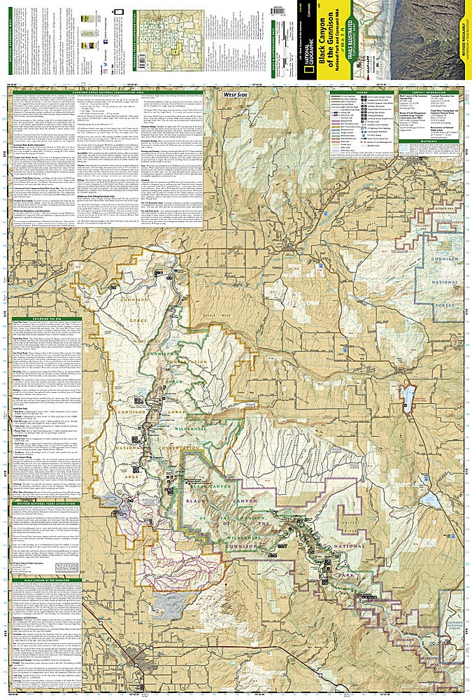
Nestled in western Colorado, this map covers the park plus Curecanti National Recreation Area, Blue Mesa Reservoir, and nearby towns like Montrose and Hotchkiss. Designed for adventurers, it details hiking trails on both canyon rims, distinguishes roads by type, and highlights campgrounds, fishing spots, and river rapids. Waterproof and tear-resistant, this map is your ultimate guide to safely exploring one of America’s most awe-inspiring natural wonders.
- 1" = 1 mile / 1cm = .6km
- Contour interval 80 feet
- Waterproof
SKU: SKU:TRA245
View full details