National Geographic
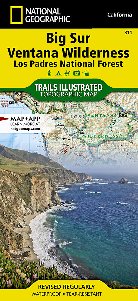
Big Sur / Ventana Wilderness Trails Illustrated Topographic Map #814
Big Sur / Ventana Wilderness Trails Illustrated Topographic Map #814
Couldn't load pickup availability
Share
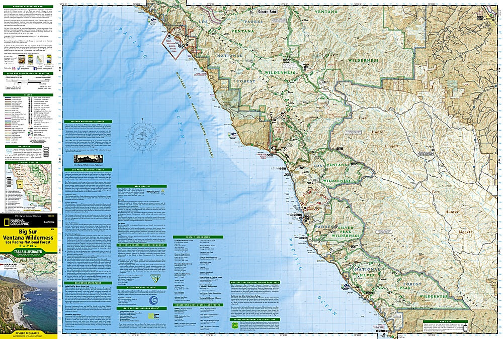
Discover California’s legendary coastline with the Big Sur / Ventana Wilderness Trails Illustrated Topographic Map #814 by National Geographic. Covering rugged stretches of Los Padres National Forest, the wild beauty of Silver Peak Wilderness, and the cascading waterfalls of Julia Pfeiffer Burns State Park, this waterproof, tear-resistant map is your gateway to adventure. Hike to panoramic coastal vistas, explore redwood-shaded canyons, or trace the wild course of the Big Sur National Wild and Scenic River.
Steeped in history, the Big Sur region was once home to the Esselen and Rumsen Ohlone peoples, later attracting Spanish explorers and early homesteaders. Today, it’s a haven for hikers, campers, and road-trippers seeking awe-inspiring views along the Pacific Coast Highway.
With detailed topography, clearly marked trails, GPS-friendly UTM grids, and recreation features from fishing spots to campgrounds, this map ensures you’ll experience every mile of Big Sur’s untamed majesty with confidence.
SKU: SKU:TRA814
View full details