National Geographic
Berlin Destination Map & Travel Guide by National Geographic
Berlin Destination Map & Travel Guide by National Geographic
Couldn't load pickup availability
Share
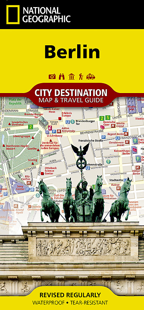
Discover Berlin like never before with the National Geographic Berlin Destination Map & Travel Guide, your ultimate companion to Germany’s vibrant capital. This detailed, double-sided map blends expert cartography with a wealth of travel information, making it ideal for both first-time visitors and seasoned explorers. The city map highlights Berlin’s intricate road network, pedestrian zones, and public transit lines, with U-Bahn and S-Bahn stations clearly marked for easy navigation. Hundreds of attractions are pinpointed, including the iconic Brandenburg Gate, the towering Fernsehturm, and the majestic Berliner Dom—many shown in stunning 3D detail.
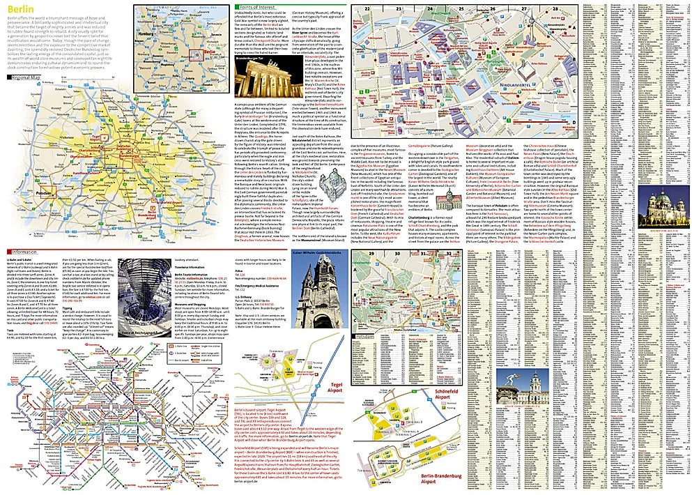
Flip the map over to explore a regional overview, in-depth descriptions of top sights, and inset maps of Potsdam, Schloss Charlottenburg, and the downtown core. You’ll also find airport diagrams, a handy street index, and a transit system overview. Printed on waterproof, tear-resistant synthetic paper, this map is built to withstand all your Berlin adventures.
SKU: SKU:NGSDBER
View full details