

National Forest Service
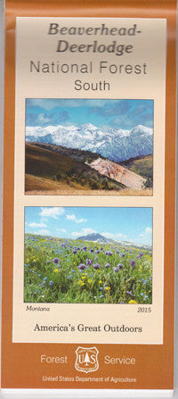
Beaverhead - Deerlodge National Forest - South Region USFS Map
Beaverhead - Deerlodge National Forest - South Region USFS Map
Couldn't load pickup availability
Share
Discover the untamed beauty of Montana’s Beaverhead - Deerlodge National Forest South Region with this detailed Forest Service Map. Covering the scenic lands south of Dillon and along the Montana/Idaho border, this map guides you through charming towns like Leodore, Lima, and Varney.
Hike the rugged trails of the Snowcrest and Gravelly Ranges, explore the serene waters of Clark Canyon Reservoir, or journey along Highway 15 for breathtaking vistas. Popular attractions include the vibrant wildlife of Red Rock Lakes National Wildlife Refuge, historic Bannack Ghost Town, and the stunning Madison River Valley. Immerse yourself in lush forests of lodgepole pine and Douglas fir, while spotting elk, moose, bald eagles, and more.
Perfect for outdoor enthusiasts, this map helps you plan your next adventure in Montana’s wild heart. Get ready to explore and experience the natural wonders of the Beaverhead - Deerlodge National Forest!
SKU: SKU:NFMTBEDES
View full details