National Geographic
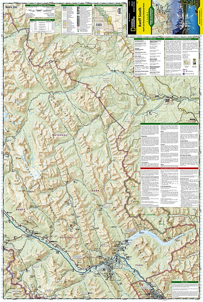
Banff South Trails Illustrated Topographic Map #900
Banff South Trails Illustrated Topographic Map #900
Couldn't load pickup availability
Share
Discover the breathtaking beauty of the Canadian Rockies with the Banff South Trails Illustrated Topographic Map #900 by National Geographic. Covering the southern half of Banff National Park and parts of Kootenay National Park, this waterproof, tear-resistant map is your trusted guide to iconic spots like Lake Minnewanka, Johnston Canyon, and the charming town of Banff. Explore scenic trails winding through glaciers, rugged peaks, and alpine meadows, with clearly marked distances for hiking, biking, and horseback riding. You'll also find detailed information on campgrounds, hot springs, and fishing areas.
Step into history as you travel routes once used by early explorers and First Nations peoples, in a region protected since Banff became Canada’s first national park in 1885. Whether you're heading for the Ghost River Wilderness or the dramatic Mount Assiniboine, this map gives you the geographic context, trail precision, and backcountry details you need to experience the Rockies at their wildest.
SKU: SKU:TRA900
View full details