National Geographic
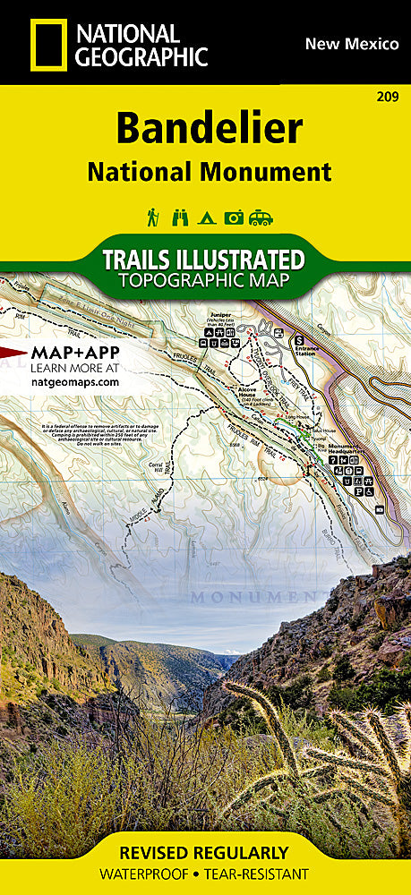
Bandelier National Monument Trails Illustrated Topographic Map #209
Bandelier National Monument Trails Illustrated Topographic Map #209
Couldn't load pickup availability
Share
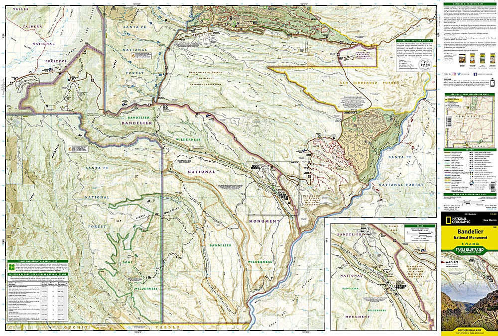
Explore the captivating ruins and rugged canyons of northern New Mexico with the Bandelier National Monument Trails Illustrated Topographic Map #209 by National Geographic. This waterproof, tear-resistant map is your essential guide to ancient cliff dwellings, scenic trails, and volcanic terrain.
Discover three of the park’s top attractions: the Main Loop Trail to Tyuonyi Pueblo and Alcove House, the remote wilderness of Frijoles Canyon, and the sweeping views from Cerro Grande. Nestled on the Pajarito Plateau near Los Alamos, Bandelier preserves over 11,000 years of human history, where ancestral Puebloans built homes into the soft tuff rock. The map details hiking routes from the visitor center, including trail distances and estimated times, plus features like campgrounds, archeological sites, and forest roads.
With contour lines, UTM grids, and boundaries clearly marked, this map is perfect for both casual hikers and seasoned explorers eager to connect with the region’s natural beauty and cultural past.
SKU: SKU:TRA209
View full details