Kroll Map Company
Bainbridge Island Terrain Map by Kroll Map Company
Bainbridge Island Terrain Map by Kroll Map Company
Couldn't load pickup availability
Share
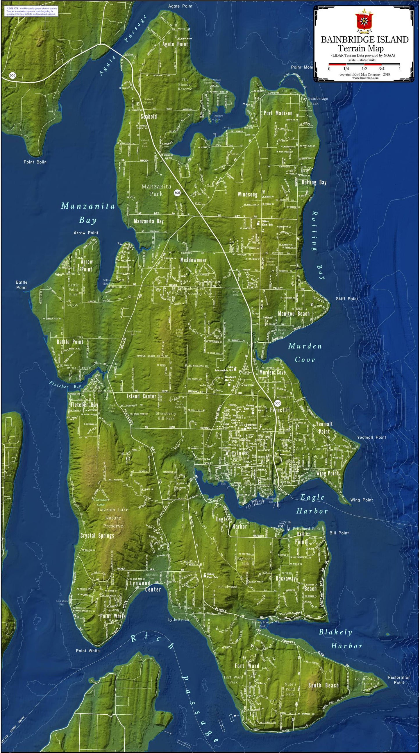
The Map of Bainbridge Island by local publisher, Kroll Map, is a meticulously crafted cartographic work of art that seamlessly combines aesthetic appeal with functional utility. This expertly designed map is not just a visual delight but a comprehensive guide to the intricate network of streets and waterways that define Bainbridge Island's charm.
The Map of Bainbridge Island, presented on a durable paper or laminated surface, captures the essence of this enchanting locale in extraordinary detail. The streets weave across the island with precision, providing a clear and accurate representation of the urban landscape. Navigating through the charming neighborhoods and bustling thoroughfares becomes a breeze with this intricately mapped guide.
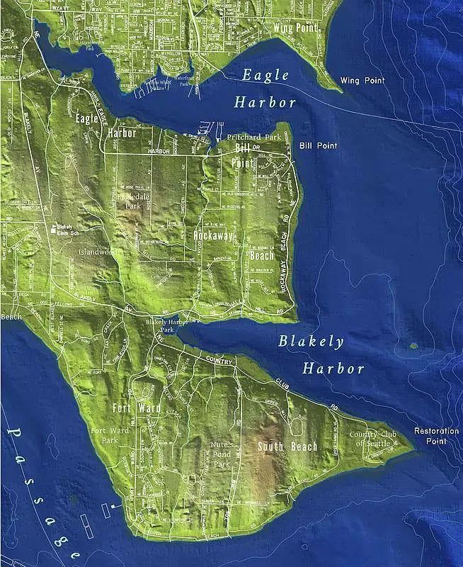
What sets this map apart is its innovative use of terrain shading for the land and lidar shading for the water depths. The topographical intricacies of Bainbridge Island come to life as the terrain shading gracefully highlights the elevation changes, giving a three-dimensional feel to the landscape. Meanwhile, lidar shading elegantly illustrates the varying depths of the surrounding waters, adding a layer of sophistication to the map's aquatic features.
The Map of Bainbridge Island doesn't just stop at showcasing the streets and water bodies; it takes you on a journey through the island's distinctive bays and regions. Eagle Harbor, with its bustling marina and waterfront charm, is prominently featured, providing a visual anchor to the map. Rich in historical significance, this bay is a focal point for both residents and visitors alike.
Traverse the contours of Murden Cove, where the lidar shading skillfully reveals the hidden depths beneath the surface or explore the scenic beauty of Port Madison. Each bay and region on the map tells a unique story, inviting exploration and fostering a deeper connection with the island.
SKU: SKU:KROBIST
View full details