USGS
Astoria WA Area 1:24K USGS Topo Maps
Astoria WA Area 1:24K USGS Topo Maps
Couldn't load pickup availability
Share
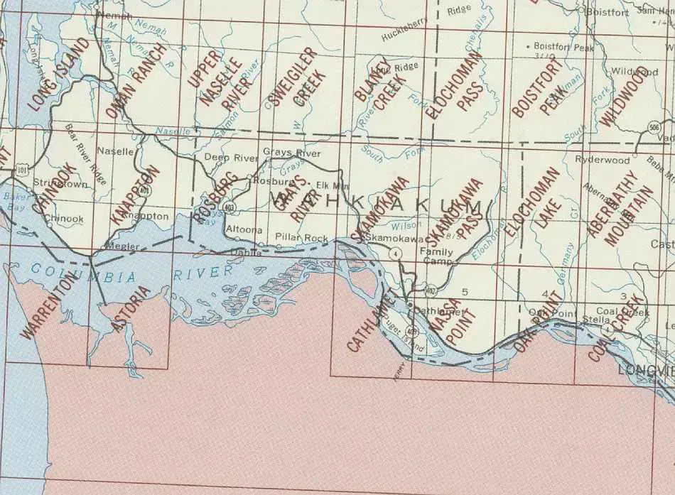
The Astoria Area is split between Washington and Oregon and includes the mouth of the Columbia River. Founded in 1811, Astoria is the oldest city in the state of Oregon and was the first permanent American settlement west of the Rockies. We have John Jacob Astor, a New York Financier, to thank for that. He sent fur traders to the area and the trading post of Fort Astoria was established.
We personally think the most interesting map title in this group is.. Skamokawa! For those of you who don't know - Skamokawa is a Chinook term for smoke or fog on the water. Skamokawa is also home to one of five covered bridges in Washington State. A rarity over here on the West Coast!
The 7.5 minute maps by USGS are the most detailed topographic maps of Washington State and are the best tool for figuring out the shape of the land using contour lines. Hills, depressions, cliffs, plateaus, and other physical features are clearly marked on these maps, while colors and symbols indicate whether these hills are wooded or clear. Roads, trails, power lines and shelters are also marked.
Each map measures approximately 22" x 27".
SKU: SKU:
View full details