Rand McNally
Arizona State Highway Laminated Map by Rand McNally - Easy to Fold
Arizona State Highway Laminated Map by Rand McNally - Easy to Fold
Couldn't load pickup availability
Share
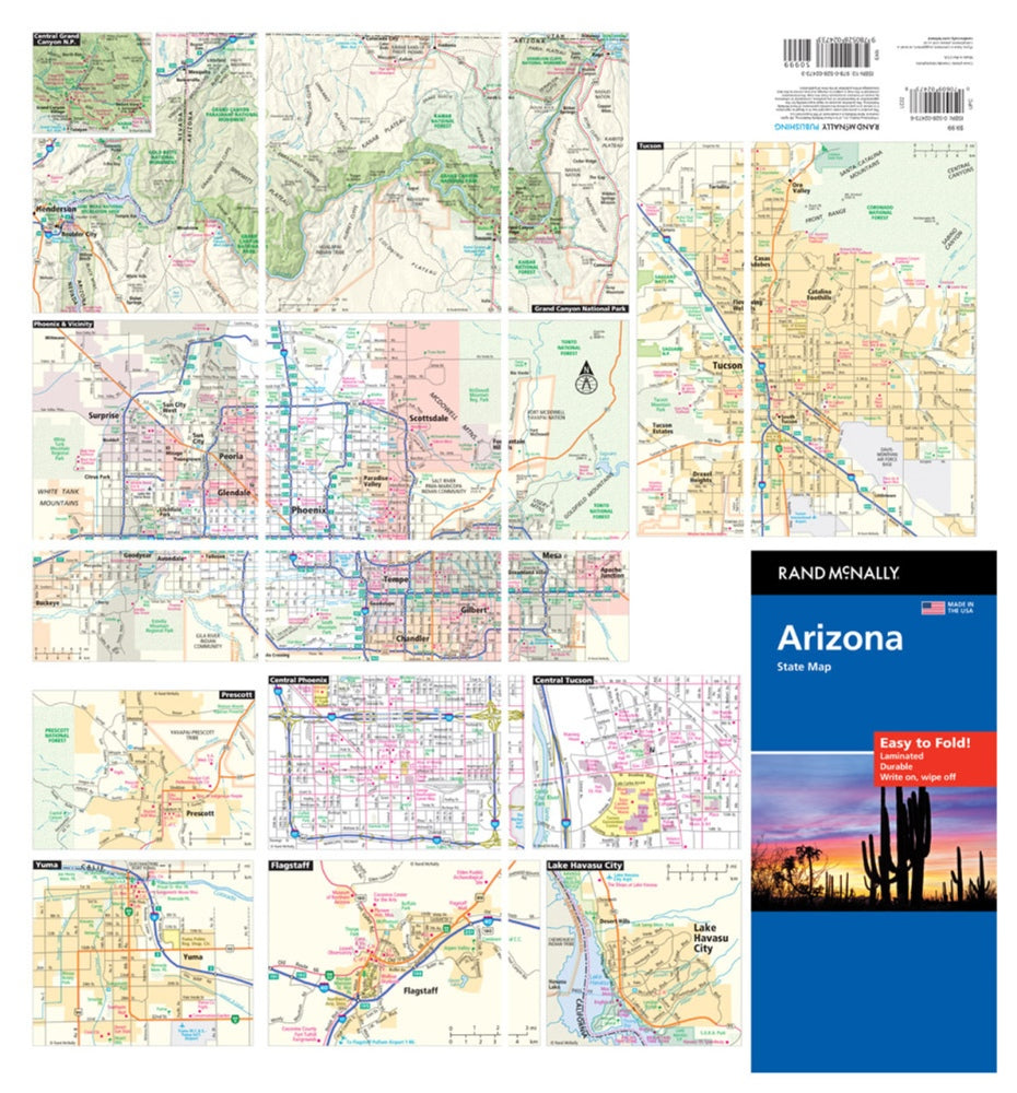
Discover Arizona like never before with the Easy to Fold, laminated Arizona State Highway Map by Rand McNally—your road trip’s most reliable copilot from the very first mile. Unlike digital screens that glare, freeze, or fade in the sun, this rugged laminated map lets you plan routes, jot notes, and wipe it clean for your next adventure without ever wearing out.
Built for the twists and turns of the Grand Canyon State’s 6,000+ miles of paved roads, this tear-resistant map folds smoothly into crisp sections—no more clumsy refolding battles. Its vibrant, full-color cartography highlights highways, county lines, scenic byways, and local landmarks, plus a quick-reference legend and city index for fast navigation.
And for a must-see hidden gem, don’t miss the volcanic wonder of Sunset Crater near Flagstaff—an unforgettable stop that belongs on every Arizona itinerary. Perfect for residents, explorers, and anyone chasing the wide-open roads of the Southwest.
SKU: SKU:RMCUSAZE
View full details