National Geographic
Appalachian Trail Great Treks Planning Map by National Geographic
Appalachian Trail Great Treks Planning Map by National Geographic
Couldn't load pickup availability
Share
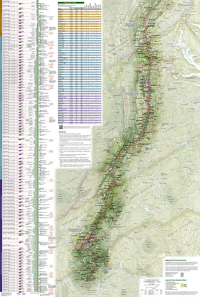
Big miles. Epic views. One legendary trail. The Appalachian Trail Great Treks Planning & Overview Map #5501 by National Geographic is your all-in-one game plan for conquering America’s most iconic long-distance hike.
Spanning nearly 2,200 miles from Georgia’s Springer Mountain to Maine’s Mount Katahdin, the Appalachian Trail winds through 14 states, tracing the rugged spine of the Appalachian Mountains. First proposed in 1921 and completed in 1937, this historic footpath connects generations of hikers to wild landscapes, small trail towns, and unforgettable summit moments.
From the misty peaks of Great Smoky Mountains National Park to the panoramic cliffs of McAfee Knob and the alpine beauty of Mount Katahdin, this map highlights three of the trail’s most sought-after milestones. Detailed trail charts break down cumulative mileage, elevation gain and loss, average slope, and section distances—so you can plan smarter whether you’re tackling a weekend section or a full thru-hike.
Coverage includes nearby towns, shelters, campsites, river crossings, parking areas, and resupply options, plus a full latitude/longitude grid for GPS navigation. Printed on waterproof, tear-resistant paper, it’s built for the backcountry—and built to get you to the next blaze with confidence.
SKU: SKU:TRA5501
View full details