1
/
of
1
Kroll Map Company
Oahu 1881 Antique Map Reproduction
Oahu 1881 Antique Map Reproduction
Regular price
$34.95 USD
Regular price
Sale price
$34.95 USD
Unit price
/
per
Couldn't load pickup availability
Share
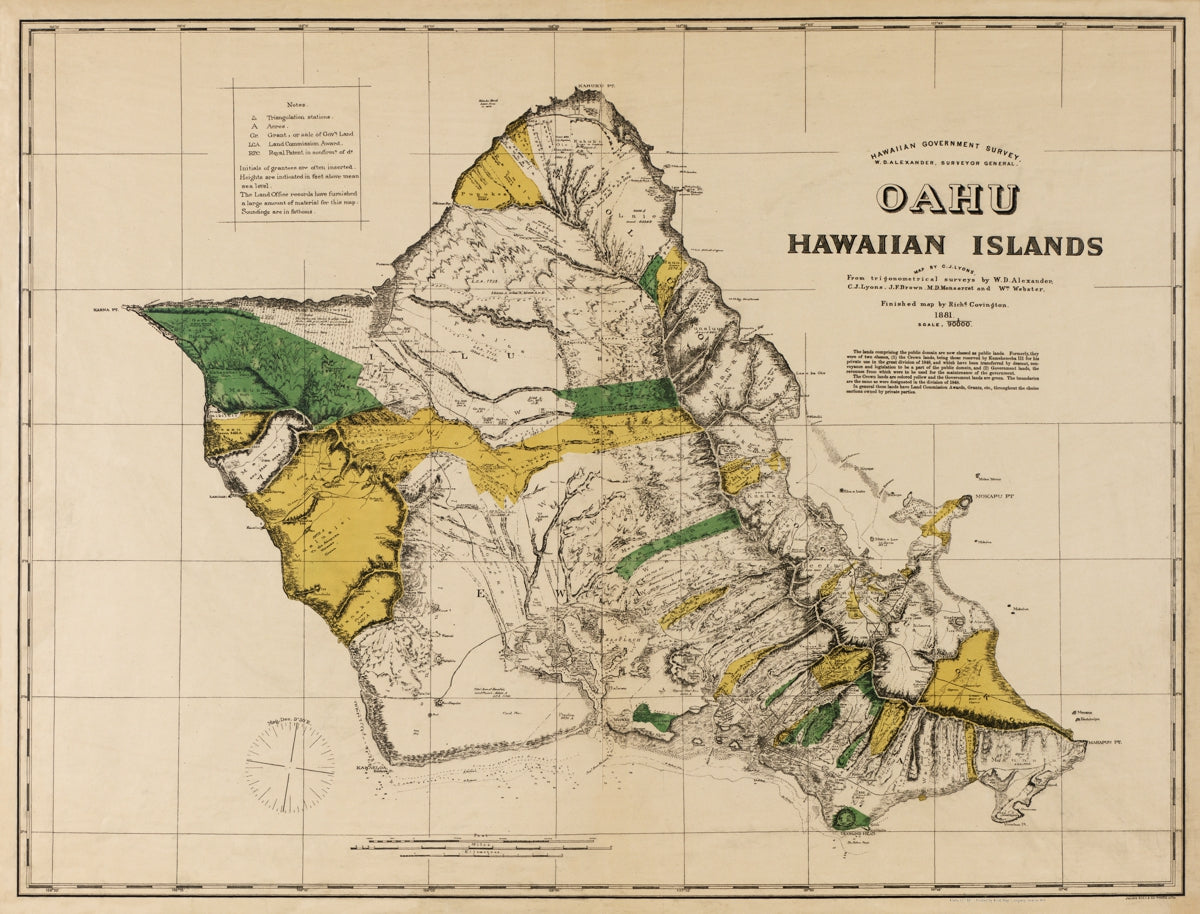
This Antique Reproduction Map of Oahu published in 1881 was created 18 years before U.S. annexation in 1899.
It shows detailed topography, land ownership, and infrastructure improvements. Manuscript notes on river systems suggest use in early water projects.
The verso bears the name of M.M. O’Shaughnessy, who helped design water systems for 20 Hawaiian sugar plantations and built three major aqueducts. The map features full color, hachures, and spot heights.
A valuable record of early Hawaiian development, this map is closely tied to O’Shaughnessy’s engineering work and complements his 1899 and 1906 maps of Oahu.
Size: 36" x 27"
SKU: SKU:KROLCOAH1881
View full details