1
/
of
1
Kroll Map Company
Minnesota 1874 Antique Map Reproduction
Minnesota 1874 Antique Map Reproduction
Regular price
$39.95 USD
Regular price
Sale price
$39.95 USD
Unit price
/
per
Couldn't load pickup availability
Share
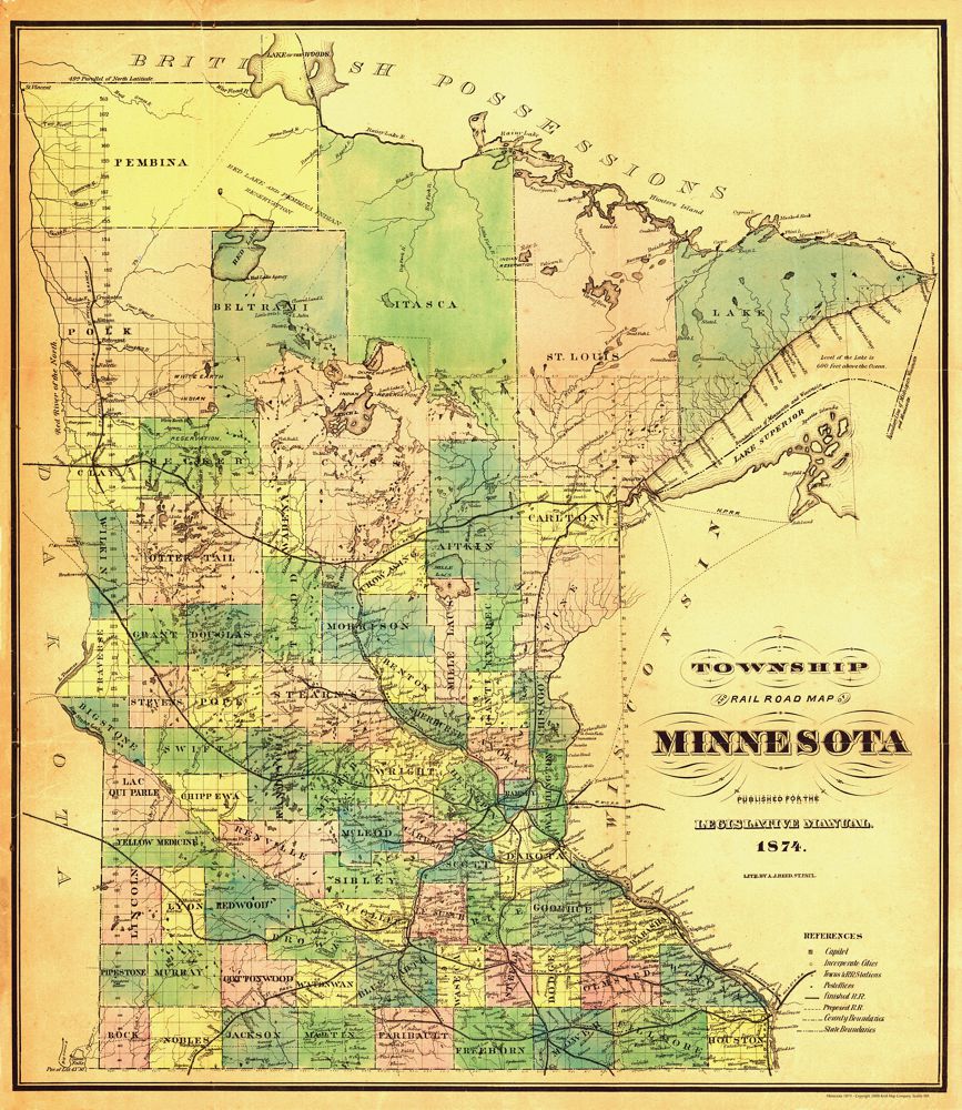
This Antique Reproduction Map of early Minnesota, published in 1874, is among the first maps of the state printed locally.
Produced by the short-lived Northwestern Lithographing Co., it shows counties in color, along with cities, townships, post offices, railroad stations, and proposed rail lines. A dividing ridge in northern Minnesota marks the watershed between Hudson Bay and the Gulf of Mexico.
Only one known copy survives, held by the Minnesota Historical Society.
Created by Reed—whose mapmaking career appears brief—this map reflects the limited but growing cartographic activity in Minnesota before 1875, when few maps were printed within the state.
Size: 32" x 36"
SKU: SKU:KROLCMN1874
View full details