Kroll Map Company
Maui 1885 Antique Map Reproduction
Maui 1885 Antique Map Reproduction
Couldn't load pickup availability
Share
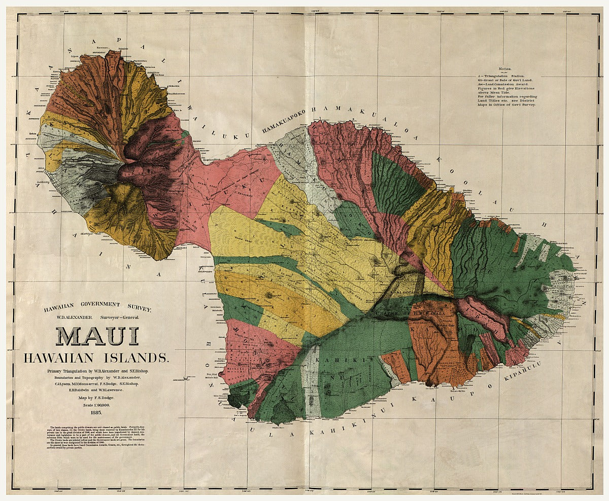
This impressively detailed 1885 Antique Reproduction Map of Maui was published in 1906 for the U.S. Territorial Governor’s report following Hawaii’s annexation.
Originally begun during the Hawaiian Monarchy, the map was part of an effort to evaluate the island’s land use and development potential under U.S. administration.
It highlights public lands, homestead tracts, grazing areas, pineapple and sugar plantations, forest reserves, wetlands, and more.
Created by leading Hawaiian surveyors and cartographers including W.D. Alexander and S.E. Bishop, this map is both a historical document and a remarkable example of early Hawaiian cartography.
Size: 36" x 27"
SKU: SKU:KROLCMAU1885
View full details