International Travel Maps
Antigua St. Kitts & Nevis Travel Map
Antigua St. Kitts & Nevis Travel Map
Couldn't load pickup availability
Share
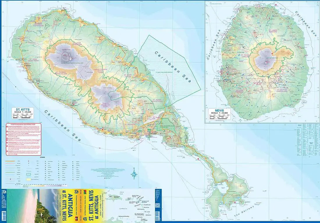
Discover the vibrant Caribbean trio of Antigua, St. Kitts & Nevis with this Antigua, St. Kitts & Nevis Travel Map ITM, your comprehensive companion to these tropical paradises. Designed ITM, this latest edition seamlessly merges the allure of Antigua with the enchanting landscapes of nearby St. Kitts and Nevis, while also featuring a charming inset map of Barbuda for added exploration.
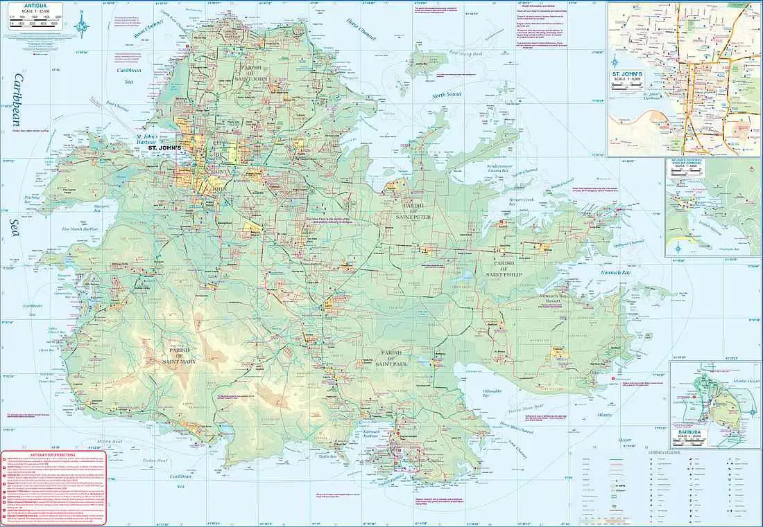
Unfolding to reveal a wealth of detail, side 1 of this double-sided Antigua, St. Kitts & Nevis Travel Map unveils the expansive beauty of the island of Antigua, adorned with intricate road networks and highlighted a detailed inset map of St. John’s, the capital city bustling with Caribbean charm. Delve into history at the southern tip of Antigua, where Nelson’s Dockyard stands as a testament to centuries past, servicing British naval ships and now beckoning visitors with its historical allure.
Navigate with ease using the legend that includes classifications of roads, rivers, lakes, national parks, airports, and more, ensuring you don't miss a single highlight. From winding coastal roads to hidden gems nestled inland, this map encapsulates the essence of exploration in these idyllic locales.
SKU: SKU:ITMANTSKITNEV
View full details