National Geographic
Antarctica Satellite Wall Map by National Geographic
Antarctica Satellite Wall Map by National Geographic
Couldn't load pickup availability
Share
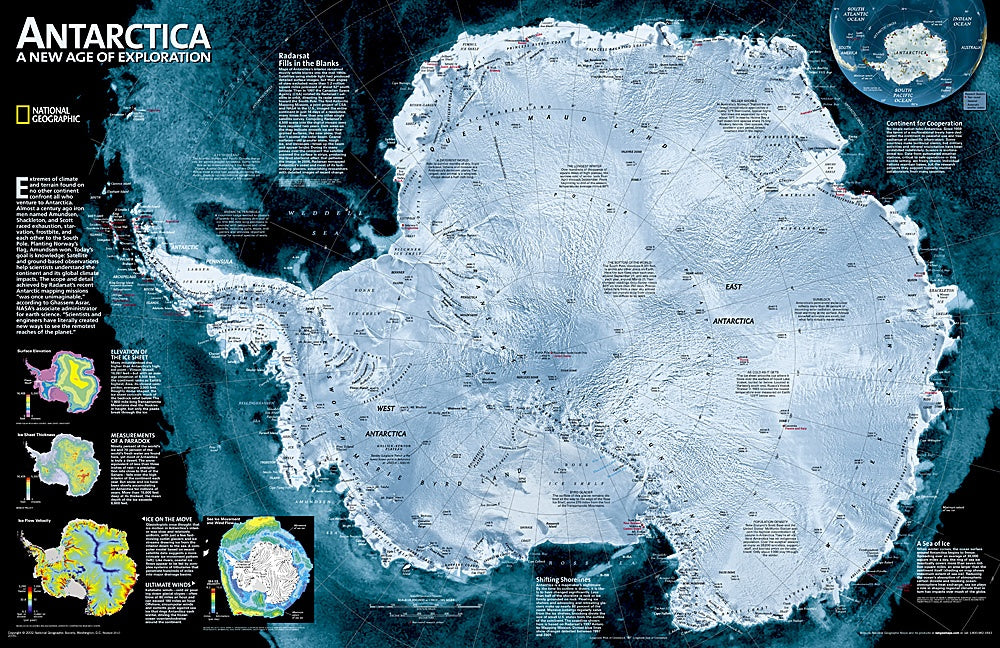
Explore the frozen frontier with the Antarctica Satellite Wall Map by National Geographic—an awe-inspiring 31" x 20" map available in paper or laminated format. Created from over 4,500 satellite scans, this map reveals Antarctica’s breathtaking terrain in extraordinary detail, from massive ice shelves and intricate ice streams to towering peaks and hidden valleys. Inset maps display fascinating data on ice sheet thickness, surface elevation, ice flow velocity, and sea ice drift with wind patterns, offering a scientific and visual deep dive into Earth’s southernmost continent.
Ideal for classrooms, offices, or any space that celebrates adventure and science, this map also marks the locations of international research stations along with their sponsoring countries. Whether you're a polar researcher, geography enthusiast, or just captivated by the mysteries of the South Pole, the Antarctica Satellite Wall Map is a striking and informative centerpiece. Navigate the extremes with National Geographic’s unmatched cartographic precision.
SKU: SKU:NGSANS
View full details