International Travel Maps
Antarctica and Tierra del Fuego Map
Antarctica and Tierra del Fuego Map
Couldn't load pickup availability
Share
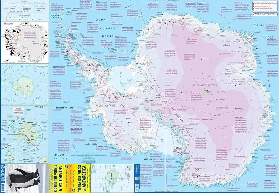
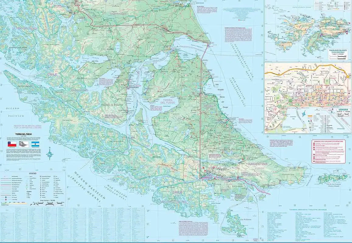
Antarctica & Tierra del Fuego Travel Map: The ITMB Antarctica & Tierra Del Fuego Travel Map offers an exceptional guide for anyone drawn to Earth’s southernmost wonders. This double-sided, folded map is expertly crafted at a scale of 1:7,000,000 for Antarctica and 1:750,000 for Tierra del Fuego, showcasing two distinct yet captivating worlds. One side of the map captures Antarctica’s icy expanse with unparalleled detail, highlighting its dramatic coastline, which reflects both its 1980 and present-day outlines, documenting the changes spurred global warming. As you trace the path of modern-day explorers, the map’s informative text blocks reveal fascinating tidbits, such as the discovery of dinosaur fossils and the unique fact that Antarctica has three poles.
SKU: SKU:ITMANT
View full details