International Travel Maps
Amsterdam & Netherlands Travel & Reference Map by ITMB
Amsterdam & Netherlands Travel & Reference Map by ITMB
Couldn't load pickup availability
Share
Explore the heart of the Netherlands with ITMB’s double-sided, waterproof Amsterdam & Netherlands Travel & Reference Map. The Amsterdam city map (1:8,000 scale) takes you from Rembrandt Park to the bustling harbor, and from the green spaces of Volkstuin Park to below the iconic Vondels Park. Discover key landmarks like the Anne Frank House, Rijksmuseum, and the Heineken Experience. All tram routes, Metro lines, railways, hotels, restaurants, and top attractions are clearly marked, making navigation a breeze. A handy list of Amsterdam’s must-see sights is also included.
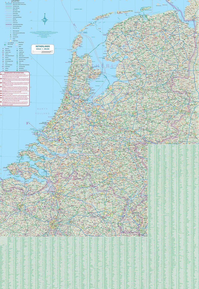
Flip the map over for a detailed country map of the Netherlands (1:400,000 scale), extending into northern Belgium as far as Brussels. Highways, national parks, airports, rivers, and historic towns are easy to spot. Unique to this map, every windmill across the country is shown—highlighting a beloved symbol of Dutch culture.
Printed on durable, eco-friendly stone paper, this map is built to travel.
SKU: SKU:ITMAMS
View full details