National Geographic
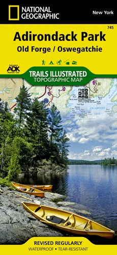
Adirondack Park (Old Forge) Trails Illustrated Map #745
Adirondack Park (Old Forge) Trails Illustrated Map #745
Couldn't load pickup availability
Share
Get ready to explore the wild beauty of New York’s Adirondack Park with National Geographic’s Trails Illustrated Topographic Map #745, focused on the Old Forge and Oswegatchie region. This waterproof, tear-resistant map is packed with everything an adventurer needs—whether you’re hiking through the Five Ponds Wilderness, paddling across the Fulton Chain Lakes, or snowshoeing near the Stillwater Reservoir.
Trails like the Cranberry Lake 50 are clearly marked with mileage, so planning a backcountry loop or a day trip is a breeze. You’ll find details on campgrounds, ski areas, boat launches, and swimming spots, plus access points for fishing and canoeing. With topographic contour lines, GPS-friendly UTM coordinates, and recreation icons throughout, this map is your perfect companion for any season.
Developed with input from local experts, including the Adirondack Mountain Club, it’s more than just a map—it’s your gateway to unforgettable adventures in the heart of the Adirondacks.
SKU: SKU:TRA745
View full details