National Geographic
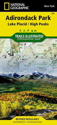
Adirondack Park (Lake Placid) Trails Illustrated Map #742
Adirondack Park (Lake Placid) Trails Illustrated Map #742
Couldn't load pickup availability
Share
Discover the rugged beauty of the Adirondacks with National Geographic’s Trails Illustrated Topographic Map #742, your essential guide to exploring the Lake Placid region. Covering the heart of the largest park in the contiguous U.S., this detailed map puts you at the trailhead of High Peaks Wilderness, Saranac Lakes Wild Forest, Hurricane Mountain, Lake Champlain, and more.
Whether you're trekking up Giant Mountain, paddling Long Lake, or snowshoeing through the Sentinel Range, the included High Peaks Trail Chart helps you find the perfect path for your adventure. Trails are clearly marked with mileage between points, and icons guide you to campsites, trailheads, fishing spots, boat launches, and scenic lookouts.
Contour lines and elevation data help you navigate confidently through every peak and pass. Printed on waterproof, tear-resistant paper, this map is built as tough as the terrain it covers—ready for whatever the Adirondacks throw your way.
SKU: SKU:TRA742
View full details