National Geographic
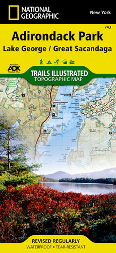
Adirondack Park (Lake George) Trails Illustrated Map #743
Adirondack Park (Lake George) Trails Illustrated Map #743
Couldn't load pickup availability
Share
Whether you're scaling forested ridges, paddling the calm waters of Lake George, or snowshoeing through fresh powder near Great Sacandaga, the Adirondack Park (Lake George) Topographic Map #743 by National Geographic is your all-season adventure guide.
Packed with trails that range from easy strolls to rugged treks, this map shows distances between trail intersections and includes a handy chart to match your route with your favorite activity—hiking, biking, horseback riding, skiing, and more. Explore wild gems like Pharoah Lake Wilderness, Hammond Pond, and Wilcox Lake wild forests, or plan a weekend around Moreau Lake State Park and Lake Luzerne. The map’s detailed topography reveals contour lines, summits, and scenic lakes, while icons pinpoint campsites, boat launches, fishing holes, climbing spots, and winter sports areas.
Waterproof, tear-resistant, and GPS-friendly, this map is your trusty sidekick for making memories in New York’s iconic Adirondacks—where the views are big and the trails even bigger.
SKU: SKU:TRA743
View full details