

Kroll Map Company
World 1513 Piri Reis Antique Map Reproduction
World 1513 Piri Reis Antique Map Reproduction
Couldn't load pickup availability
Share
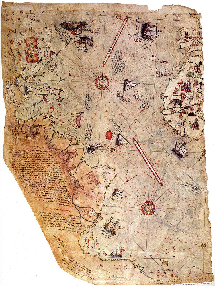
The Piri Reis map, created in 1513 by the Ottoman admiral and cartographer Piri Reis, is a remarkable artifact of early cartography.
Preserved in the Topkapi Palace in Istanbul, only about one-third of this world map remains. Its rediscovery in 1929 stirred significant interest due to its inclusion of a fragment from a lost map by Christopher Columbus.
This portolan chart features compass roses and a windrose network for navigation, eschewing the more modern lines of longitude and latitude.
Scholars suggest that the map’s unusual portrayal of the Caribbean reflects a now-lost map from Columbus that inaccurately represented Cuba as part of Asia and Hispaniola according to Marco Polo's description of Japan.
The map’s depiction of the southern Atlantic coast is thought to represent a version of Terra Australis.
Visually, the map stands out from European portolan charts with its Islamic miniatures and incorporates a mix of Islamic and non-Muslim sources. Historian Karen Pinto notes that the map challenges the medieval Islamic view of the world’s "inhabited quarter," surrounded by an impassable Encircling Ocean.
Debate continues over the map’s origins and sources. Some interpretations have even suggested visual similarities to uncharted parts of the Americas or even an ice-free Antarctic coast, although these theories lack concrete evidence.
Size: 23" x 30"
SKU: SKU:KROLCW1513
View full details