1
/
of
1
Green Trails
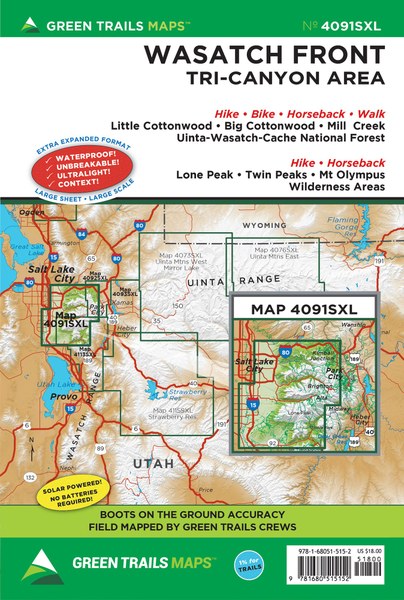
Wasatch Front, UT Green Trails map 4091SXL
Wasatch Front, UT Green Trails map 4091SXL
Regular price
$20.00 USD
Regular price
Sale price
$20.00 USD
Unit price
/
per
Couldn't load pickup availability
Share
Wasatch Front, UT Green Trails map 4091SXL
Extra-large 22.5 x 36 unfolded (shipped folded, 6 x 9) waterproof, tear resistant, ultralight map printed on Polyart.
Areas covered:
Each map includes:
Areas covered:
- Little Cottonwood
- Big Cottonwood
- Mill Creek
- Parleys Canyon
- Guardsman Pass
- Uinta-Wasatch-Cache National Forest
- Lone Peak
- Uinta-Wasatch-Cache National Forest
- Twin Peaks
- Mt Olympus Wilderness Area
Each map includes:
- Trails coded for hikers only, as well as mountain bikers, stock, skiers, and snowmobilers
- Icons for parking and picnic areas, tent camping and RV spaces, bathrooms and backcountry toilets, points of interest, waterfalls, springs, and gates
- Dot-to-dot trail distances, contour intervals, adjacent map numbers, and permits required
- Land designations: national and state parks, national forest, wilderness, DNR land, private land, tribal land, and othersz
Map Scale 1:35250