National Geographic
Olympic National Park Day Hikes Topographic Map Guide Booklet #1716
Olympic National Park Day Hikes Topographic Map Guide Booklet #1716
Couldn't load pickup availability
Share
Here's an adventure that packs Olympic National Park's greatest day hikes into one rugged, trail-ready guide! Whether you're chasing waterfalls, alpine vistas, or lush rainforest paths, this topographic map booklet makes every mile more rewarding.
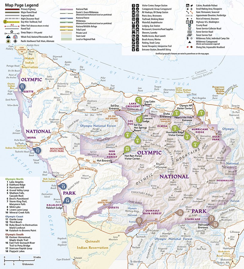
The Olympic National Park Day Hikes Topographic Map Guide Booklet #1716 by Trails Illustrated showcases 16 carefully selected hikes spanning nearly 100 miles of unforgettable terrain across Washington's legendary Olympic Peninsula. Covering everything from peaceful forest walks to challenging mountain climbs, it's the perfect companion for hikers of every skill level. Explore iconic destinations like Hurricane Ridge, the crystal-clear waters of Lake Crescent, and the breathtaking summit views surrounding Mount Olympus while discovering hidden gems tucked throughout the park.
Established in 1938, Olympic National Park protects nearly one million acres of extraordinary wilderness where glacier-capped peaks, temperate rainforests, wild Pacific coastline, and vibrant alpine meadows exist within one remarkable landscape. Home to thousands of unique plant and animal species, it's one of America's most biologically diverse national parks.
Each detailed topographic map includes trailhead directions, mileage, difficulty ratings, elevation profiles, total elevation gain, and concise trail descriptions to simplify trip planning. Printed on Trails Illustrated's waterproof, tear-resistant Backcountry Tough paper with a full UTM grid for GPS navigation, this durable hiking guide is built to handle every adventure.
SKU: SKU:TRA1716
View full details