International Travel Maps
New Brunswick Travel & Reference Map by ITMB
New Brunswick Travel & Reference Map by ITMB
Couldn't load pickup availability
Share
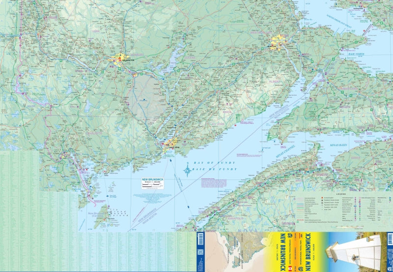
Plan your Atlantic Canada adventure with confidence using the New Brunswick Travel & Reference Map by ITMB, a double sided, folded essential for road trips, sightseeing, and armchair exploration alike. Produced at a clear and practical 1:360,000 scale, this detailed map makes it easy to navigate a province rich in scenery, coastline, and layered history.
New Brunswick sits just north of Nova Scotia, connected to Prince Edward Island by the impressive 30 km Confederation Bridge, and shares borders with Maine and Quebec’s Gaspé Peninsula. Once known as Acadie, the region reflects centuries of Acadian, British, and Loyalist heritage following the American Revolutionary War. Today, most towns still hug rivers and the coast, while the forested interior remains wonderfully remote.
Explore iconic destinations like the dramatic tides of the Bay of Fundy, the towering cliffs and flowerpot rocks of Hopewell Rocks, and the rugged beauty of Fundy National Park. The map’s legend clearly shows highways, main roads, rivers, lakes, national parks, airports, and points of interest. Measuring 27 x 39 inches unfolded, it’s a reliable travel companion for discovering one of Canada’s most historic and naturally beautiful provinces.
SKU: SKU:ITMNEWBRUNS
View full details