National Geographic
Mount Rainier National Park Trails Illustrated Topographic Map #217
Mount Rainier National Park Trails Illustrated Topographic Map #217
Couldn't load pickup availability
Share
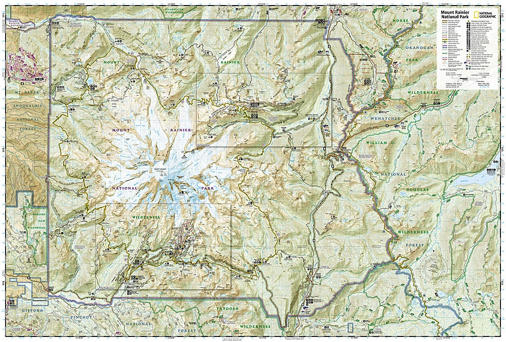
Step into the wild majesty of Mount Rainier National Park with National Geographic’s Trails Illustrated Topographic Map #217—your ultimate trail companion for adventure seekers! Whether you’re chasing epic glacier views, wandering lush subalpine meadows, or tackling the Pacific Crest and Wonderland Trails, this map puts the park’s wonders at your fingertips. Hike through the iconic Paradise area, explore the historic Longmire district, or soak in the dramatic scenery at Crystal Mountain—three must-see destinations that highlight the park’s natural and cultural treasures.
Mount Rainier isn’t just a stunning backdrop; it’s the highest peak in the Cascade Range, an active volcano, and home to the largest single-peak glacial system in the lower forty-eight states, feeding six major rivers. This map captures every contour of its valleys, passes, and summits, making it a must-have for safe and informed exploration.
Designed in collaboration with local land management agencies, this Trails Illustrated map features mileages between intersections, trailheads, scenic overlooks, campgrounds, lodges, and horse camps, plus recreation points for skiing, climbing, and more. Printed on durable, waterproof, tear-resistant paper with a full UTM grid for GPS navigation, it’s built to withstand the elements as you navigate the park’s breathtaking landscapes. From seasoned hikers to weekend wanderers, Mount Rainier Trail Map #217 is your gateway to unforgettable adventures.
SKU: SKU:TRA217
View full details