National Geographic
High Uintas Wilderness Trails Illustrated Topographic Map #711
High Uintas Wilderness Trails Illustrated Topographic Map #711
Couldn't load pickup availability
Share
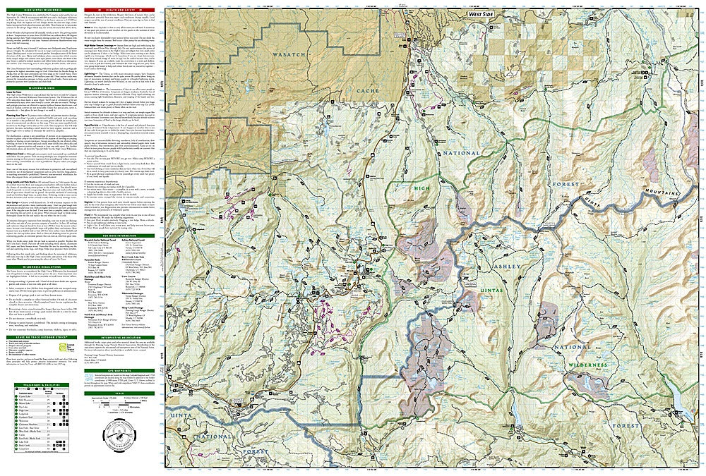
Discover one of Utah’s most breathtaking landscapes with the High Uintas Wilderness Trails Illustrated Topographic Map #711 by National Geographic. Covering the rugged Ashley and Wasatch-Cache National Forests, this waterproof, tear-resistant map is your gateway to exploring alpine lakes, glacial valleys, and Utah’s tallest peak, Kings Peak at 13,528 feet. Highlights include the sparkling Mirror Lake, the dramatic Sheep Creek Canyon Geological Area, and stretches of the wild Yellowstone River.
The High Uintas Wilderness, established in 1984, protects over 450,000 acres of pristine backcountry where explorers can still experience the untamed spirit of the American West. With hundreds of miles of trails, this map provides essential details like trailheads, campsites, and facilities, plus clear markings for snowmobile, ATV, and 4x4 routes.
Packed with contour lines, elevations, and a UTM grid for GPS navigation, this topographic map ensures a safe, unforgettable adventure through Utah’s alpine heart.