National Geographic
Great Smoky Mountains National Park Trails Illustrated Topo Map #229
Great Smoky Mountains National Park Trails Illustrated Topo Map #229
Couldn't load pickup availability
Share
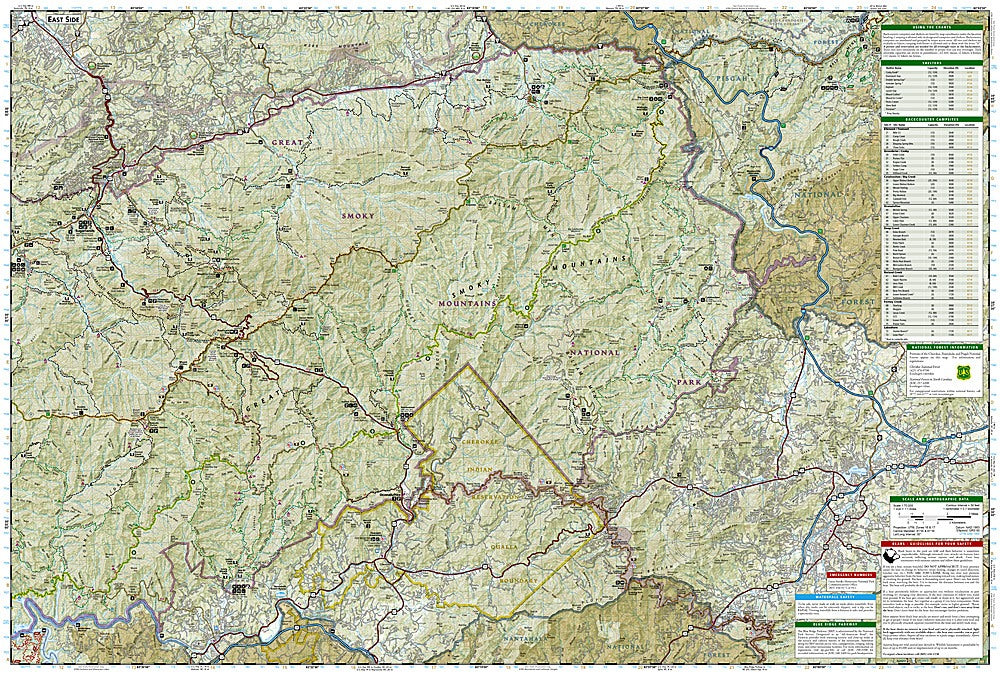
National Geographic’s Great Smoky Mountains National Park Trails Illustrated Topographic Map #229 is the ultimate guide for exploring America’s most visited national park. Nestled along the Tennessee–North Carolina border, the Smokies are famed for their mist-shrouded peaks, diverse wildlife, and rich Appalachian heritage. This detailed waterproof and tear-resistant map highlights more than 800 miles of trails, with mileage between intersections, backcountry campsites, shelters, and stream crossings clearly marked for easy navigation.
Key attractions featured include the scenic loop at Cades Cove, where visitors can step back in time with historic homesteads; the mighty Clingmans Dome, the park’s highest point at 6,643 feet, offering sweeping panoramic views; and Fontana Lake, a favorite for boating and fishing. Steeped in history, the park preserves remnants of 19th-century mountain life while also protecting one of the most biologically diverse ecosystems in the world. Perfect for hikers, campers, and nature lovers, this map ensures unforgettable adventures in the Smokies.