Mitchell Geography
Glaciers of Mount Rainier Souvenir & Reference Map
Glaciers of Mount Rainier Souvenir & Reference Map
Couldn't load pickup availability
Share
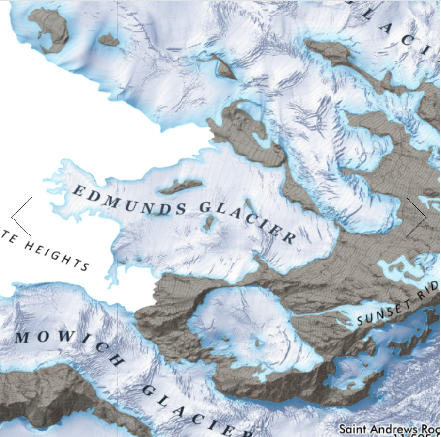
Towering ice, deep crevasses, and one of America’s most iconic volcanoes—bring the frozen crown of the Pacific Northwest home with this stunning glacier map. The Glaciers of Mount Rainier come alive in remarkable detail, making this both a striking wall display and a fascinating geographic reference.
Created using one-meter resolution USGS LIDAR terrain modeling, this beautifully rendered map by Mitchell Geography reveals the summit region of Rainier and the immense glaciers and snowfields radiating from the peak in every direction. Color-shaded relief highlights dramatic icefalls, ridges, and crevasses with exceptional clarity, showcasing features like the massive Emmons Glacier and the historic Nisqually Glacier.
The mountain itself became the centerpiece of Mount Rainier National Park in 1899, one of America’s earliest national parks and a longtime destination for climbers and explorers. Available in 13" x 19"(title across the top with slightly fewer names listed) or 20" x 24", each map is printed on heavy fine paper, creating a vibrant, high-quality souvenir that celebrates the glaciers, geography, and adventure of the Pacific Northwest.
SKU: SKU:PMG2X0003
View full details