

1
/
of
1
National Geographic
France Wall Map by National Geographic
France Wall Map by National Geographic
Regular price
$19.95 USD
Regular price
Sale price
$19.95 USD
Unit price
/
per
Couldn't load pickup availability
Share
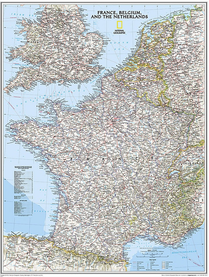
Explore France in stunning detail with National Geographic’s Classic Wall Map. Measuring 23.5" x 30.25", this beautifully designed political map captures the country’s vibrant regions, from the sun-soaked vineyards of Bordeaux to the bustling streets of Paris.
Clearly marked international boundaries, thousands of place names, major highways, airports, canals, and ferry routes make navigation simple, while shaded relief and bathymetric details add depth and visual appeal. Updated infrastructure highlights, including high-speed rail lines, oil fields, and pipelines, provide a comprehensive view for travelers, students, or geography enthusiasts. Unique geographical fact: France is home to the European continent’s highest peak, Mont Blanc, rising 15,774 feet in the Alps along the Italian border.
Neighboring countries such as Belgium, The Netherlands, Luxembourg, Germany, Switzerland, Spain, Italy, and portions of the UK are included, offering rich context for travel or study. Perfect for classrooms, offices, or travel planning, this map blends function with National Geographic’s signature aesthetic.
Articles
