Red Maps
Florence City Center Street Map by Red Maps
Florence City Center Street Map by Red Maps
Couldn't load pickup availability
Share
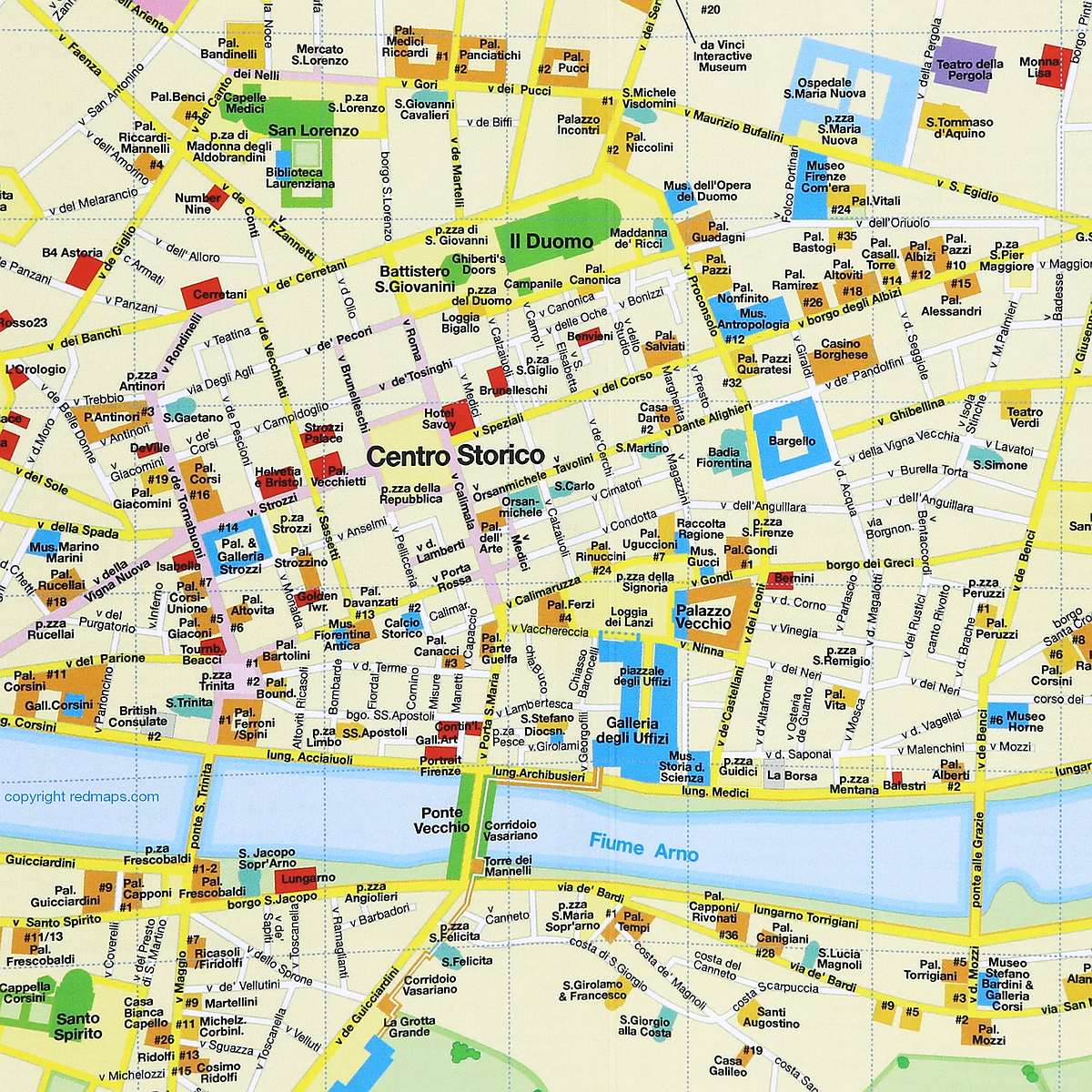
Explore the heart of the Renaissance with the Florence City Center Street Map by Red Maps. This colorful, pocket-sized companion makes navigating central Florence a breeze, thanks to its laminated design and clear layout.
Wander the cobbled streets of Centro Storico to marvel at the Duomo or browse the masterpieces of the Uffizi Gallery. Cross the Arno River into Oltrarno to explore the grand Pitti Palace and stroll through the lush Boboli Gardens. The map highlights Florence’s most beloved historical landmarks, boutique hotels, and even local shops that give the city its timeless charm. Parks, squares, and theaters are easy to locate, along with museum highlights and helpful facts to enrich your visit.
And for those tempted to venture beyond the city, a handy map of Tuscany points the way to scenic hill towns and rustic escapes. It’s the perfect guide to uncovering Florence’s elegance, culture, and irresistible Italian character.