National Geographic
Europe Wall Map - Classic Series by National Geographic
Europe Wall Map - Classic Series by National Geographic
Couldn't load pickup availability
Share
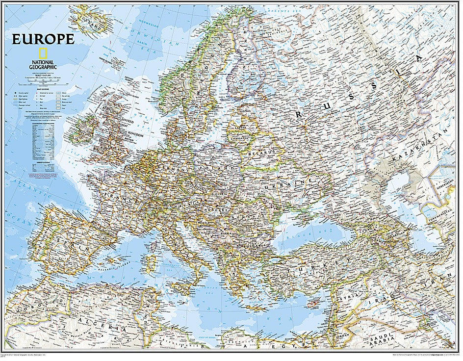
The Europe Wall Map – Classic Series by National Geographic brings the continent to life with timeless design and unmatched detail. With a bright, easy-to-read color palette and the signature Classic style, this map highlights Europe’s international boundaries, major cities, airports, and thousands of place names, all placed for maximum clarity. Subtle shaded relief showcases mountain ranges and valleys, while rivers, lakes, seas, and even glaciers provide a full picture of the landscape. Perfect for classrooms, offices, or home study, it offers both educational value and striking visual appeal.
One unique fact you’ll discover is that Norway’s coastline stretches over 62,000 miles—longer than the equator—making it one of the most intricate and breathtaking in the world. Whether you’re planning travels, teaching geography, or simply appreciating Europe’s cultural and natural wonders, this expertly researched map is an essential reference. Available in two sizes, on paper or laminated, to suit your space.
Articles