National Geographic
Death Valley National Park Trails Illustrated Topographic Map #221
Death Valley National Park Trails Illustrated Topographic Map #221
Couldn't load pickup availability
Share
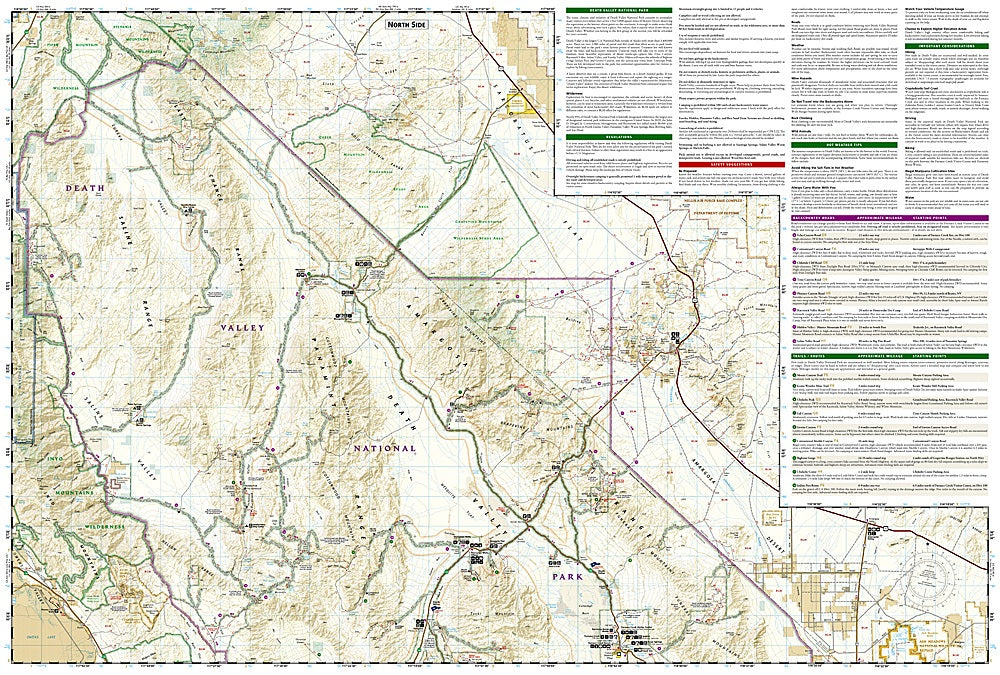
National Geographic’s Death Valley National Park Trails Illustrated Topographic Map #221 is the ultimate companion for exploring one of America’s most extreme landscapes. Covering the hottest, driest, and lowest national park in North America, this detailed map highlights must-see attractions such as Badwater Basin, the lowest point on the continent at 282 feet below sea level, the striking Mesquite Flat Sand Dunes near Stovepipe Wells, and the fascinating ruins of Scotty’s Castle, a historic landmark from the 1920s.
The map provides invaluable detail with clearly marked trails, backcountry roads, and mileage between intersections, helping visitors navigate Death Valley’s vast terrain of salt flats, canyons, badlands, and rugged mountain ranges. Contour lines, elevation data, and GPS-friendly UTM grids ensure safe and accurate navigation.
Expertly researched in partnership with local land managers, this waterproof and tear-resistant map also includes safety tips for extreme heat and backcountry travel, making it an essential tool for every Death Valley adventure.