Mitchell Geography
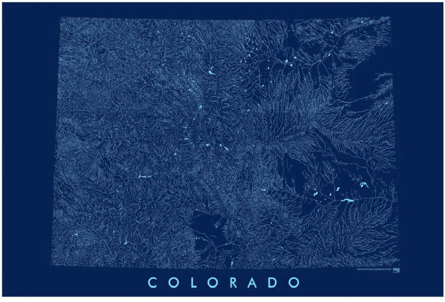
Colorado State Rivers / Hydrology Map
Colorado State Rivers / Hydrology Map
Couldn't load pickup availability
Share
Chart the waterways of the Centennial State in stunning detail with this Colorado State Rivers / Hydrology Map by Mitchell Geography. Designed to catch the eye and spark curiosity, this striking 19" x 13" map transforms Colorado’s intricate network of rivers, streams, lakes, and reservoirs into a clean, modern display piece perfect for home, office, classroom, or cabin décor.
Printed on heavy fine paper for a premium feel, this Colorado hydrology map showcases the state’s surface water systems precisely clipped to Colorado’s political boundary using the Central Colorado State Plane projection. From the mighty Colorado River to alpine reservoirs and winding mountain streams, every detail highlights the natural beauty and geographic complexity of the region.
Ideal for geography lovers, hikers, anglers, educators, engineers, and map collectors, this Colorado rivers map blends scientific accuracy with visual appeal. Whether displayed on a wall or added to a map collection, it’s a conversation-starting piece that celebrates Colorado’s legendary waterways in style.
SKU: SKU:PMGCORN01
View full details