WoodChart
Charleston, SC 3D Nautical Wood Chart
Charleston, SC 3D Nautical Wood Chart
Couldn't load pickup availability
Share
Free Ground Shipping to the Lower 48 States!!!
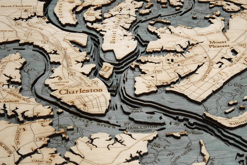
Capture the tidal beauty and storied coastline of South Carolina with this Charleston, SC 3D Nautical Wood Chart, a striking blend of coastal décor and maritime history. Located along the Atlantic seaboard where the Ashley and Cooper Rivers meet to form Charleston Harbor, Charleston has long been defined by its waterways. The city’s natural harbor made it one of the most important ports in colonial America, and its intricate network of rivers, creeks, and barrier islands continues to shape life along the Lowcountry coast. From shifting sandbars to winding tidal marshes, this handcrafted wood map transforms Charleston’s dynamic geography into an eye-catching work of art.
Charleston, SC Wood Chart points of interest include: Charleston Harbor, Wando River, Mount Pleasant, Drum Island, Stono River, Johns Island, James Island, Bull Harbor, Bull Island, and Isle of Palms. Charleston Harbor, once a strategic stronghold during the Civil War, remains one of the deepest natural harbors on the East Coast. The Wando River, stretching through scenic marshlands, is beloved by boaters and anglers for its calm waters and abundant wildlife. Isle of Palms, a barrier island just north of the harbor entrance, is known for its wide sandy beaches and sweeping Atlantic views, offering a striking contrast to the sheltered inland waterways.
Charleston, SC Nautical Wood Chart color options: Choose a Dark Brown Frame with Greenish Blue Water for a rich, classic maritime feel that highlights the lush tones of the Lowcountry marshes. Or select the Rustic Gray Frame with Grayish Blue Water for a weathered, coastal-inspired look reminiscent of driftwood and sea mist along the Atlantic shoreline.
Charleston, SC 3D Nautical Wood Chart production process: Measuring 31" x 24.5", each chart begins with detailed bathymetric depth data. An artist uses precision laser technology to cut high-quality birch wood into individual layers, which are carefully stacked and adhered to represent the true underwater contours and elevations. The water areas are hand-stained to enhance depth and dimension, while place names, roads, depths, and landmarks are intricately engraved into the surface. The finished piece is enclosed in a custom wood frame and protected with durable acrylic glass, creating a timeless tribute to Charleston’s coastal heritage.
SKU: SKU:MINCHAR
View full details