Washington Dept. of Natural Resources
Capitol State Forest Recreation Map
Capitol State Forest Recreation Map
Couldn't load pickup availability
Share
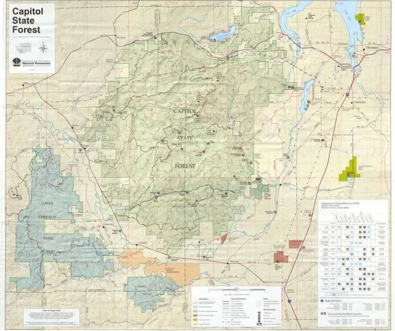
Discover Washington’s outdoor gem with the Capitol State Forest Recreation Map by the Washington Department of Natural Resources. Just a short drive west of Olympia, Capitol State Forest offers over 100,000 acres of lush forestland teeming with Douglas fir, western hemlock, and colorful wildflowers.
This folded, paper trail map is your essential guide to popular spots like Mima Falls, Middle Waddell Trail System, and Capitol Peak. Explore hiking, horseback, mountain biking, and motorcycle trails with clear contour lines, campsites, and a detailed inset of the Middle Waddell/Mima Falls area. Wildlife enthusiasts might spot black-tailed deer, Roosevelt elk, or bald eagles soaring overhead.
Whether you’re planning a day hike or an extended adventure, this map makes navigating Washington’s premier multi-use forest easy and fun. Grab your map, hit the trails, and experience Capitol State Forest today!