Canadian Hydrographic Service (CHS)
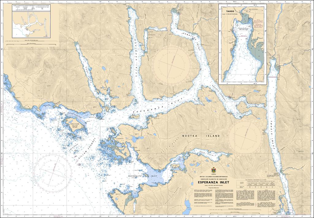
Canadian Nautical Chart #3676 - Esperanza Inlet
Canadian Nautical Chart #3676 - Esperanza Inlet
Couldn't load pickup availability
Share
Adventure begins where the coastline gets wild! Canadian Nautical Chart #3676 – Esperanza Inlet is your gateway to one of Vancouver Island's most rugged and breathtaking marine landscapes, perfect for mariners, anglers, paddlers, and coastal history enthusiasts alike.
Covering Esperanza Inlet and surrounding waterways at a detailed 1:40,000 scale, this impressive 48" x 36" Canadian nautical chart features waters around Nuchatlitz Inlet, Catala Island, Centre Island, Rosa Island, and the entrances toward Tahsis Inlet. Nearby communities such as Zeballos and Tahsis make ideal jumping-off points for unforgettable adventures along British Columbia's spectacular west coast.
The region holds an important place in Pacific Northwest history, with Spanish and British explorers charting these waters during the late 1700s as they searched for trade routes and mapped Canada's rugged coastline.
Whether you're planning your next boating expedition, researching historic waterways, or decorating a home, cabin, or office, this detailed chart delivers timeless coastal character. Equal parts navigational reference and stunning wall décor, Canadian Nautical Chart #3676 brings the beauty, history, and adventure of Esperanza Inlet ashore.
SKU: SKU:CHY3676
View full details